Nicholson Inland Waterways Map of Great Britain : For Everyone with an Interest in Britain’s Canals and Rivers
Nicholson Waterways Guides
In StockFree UK DeliveryEstimated delivery 2-3 working days
Format: Book (Sheet map, folded)
£8.99
£8.45
In StockFree UK DeliveryEstimated delivery 2-3 working days
Book (Sheet map, folded)
Add to BasketSnowdon
In StockFree UK DeliveryEstimated delivery 2-3 working days
Format: Book (Sheet map, folded)
£16.99
£12.92
In StockFree UK DeliveryEstimated delivery 2-3 working days
Book (Sheet map, folded)
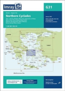
Add to BasketImray Chart G31 : Northern Cyclades
Imray
In StockFree UK DeliveryEstimated delivery 2-3 working days
Format: Book (Sheet map, folded)
£25.68
In StockFree UK DeliveryEstimated delivery 2-3 working days
Book (Sheet map, folded)
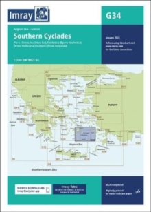
Add to BasketImray Chart G34 : Southern Cyclades
Imray
In StockFree UK DeliveryEstimated delivery 2-3 working days
Format: Book (Sheet map, folded)
£25.68
In StockFree UK DeliveryEstimated delivery 2-3 working days
Book (Sheet map, folded)
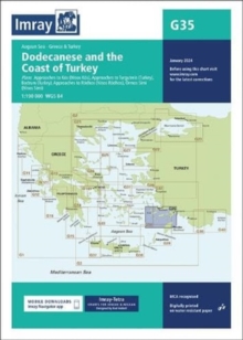
Add to BasketImray Chart G35 : Dodecanese and the Coast of Turkey
Imray
In StockFree UK DeliveryEstimated delivery 2-3 working days
Format: Book (Sheet map, folded)
£25.68
In StockFree UK DeliveryEstimated delivery 2-3 working days
Book (Sheet map, folded)
Add to BasketG1 Mainland Greece and the Peloponnisos : Passage Chart
In StockFree UK DeliveryEstimated delivery 2-3 working days
Format: Book (Sheet map, folded)
£25.68
In StockFree UK DeliveryEstimated delivery 2-3 working days
Book (Sheet map, folded)
Add to BasketImray G141 Chart : Saronikos Kolpos
Imray
In StockFree UK DeliveryEstimated delivery 2-3 working days
Format: Book (Sheet map, folded)
£25.68
In StockFree UK DeliveryEstimated delivery 2-3 working days
Book (Sheet map, folded)
Add to BasketImray Chart G15 : Southern Peloponnisos
Imray
In StockFree UK DeliveryEstimated delivery 2-3 working days
Format: Book (Sheet map, folded)
£25.68
In StockFree UK DeliveryEstimated delivery 2-3 working days
Book (Sheet map, folded)
Add to BasketImray Chart G16 : Western Peloponnisos
Imray
In StockFree UK DeliveryEstimated delivery 2-3 working days
Format: Book (Sheet map, folded)
£25.68
In StockFree UK DeliveryEstimated delivery 2-3 working days
Book (Sheet map, folded)
Add to BasketImray Chart C8 : Dover Strait
Imray
In StockFree UK DeliveryEstimated delivery 2-3 working days
Format: Book (Sheet map, folded)
£27.45
In StockFree UK DeliveryEstimated delivery 2-3 working days
Book (Sheet map, folded)
Add to BasketImray Chart C9 : Beachy Head to Isle of Wight
Imray
In StockFree UK DeliveryEstimated delivery 2-3 working days
Format: Book (Sheet map, folded)
£27.45
In StockFree UK DeliveryEstimated delivery 2-3 working days
Book (Sheet map, folded)
Add to BasketImray Chart Y14 : The Swale (Small Format)
Imray
In StockFree UK DeliveryEstimated delivery 2-3 working days
Format: Book (Sheet map, folded)
£18.84
In StockFree UK DeliveryEstimated delivery 2-3 working days
Book (Sheet map, folded)
Add to BasketImray Chart Y18 : The River Medway and Approaches
Imray
In StockFree UK DeliveryEstimated delivery 2-3 working days
Format: Book (Sheet map, folded)
£25.29
In StockFree UK DeliveryEstimated delivery 2-3 working days
Book (Sheet map, folded)
Add to BasketImray Chart Y7 : Thames Estuary South
Imray
In StockFree UK DeliveryEstimated delivery 2-3 working days
Format: Book (Sheet map, folded)
£18.84
In StockFree UK DeliveryEstimated delivery 2-3 working days
Book (Sheet map, folded)
Add to BasketImray Chart C2 : The River Thames
Imray
In StockFree UK DeliveryEstimated delivery 2-3 working days
Format: Book (Sheet map, folded)
£27.45
In StockFree UK DeliveryEstimated delivery 2-3 working days
Book (Sheet map, folded)
Add to BasketHarry Potters London the Film Location Walk : Includes Three Self-Guided Walks with Maps
Paul Garner
In StockFree UK DeliveryEstimated delivery 2-3 working days
Format: Book (Sheet map, folded)
£4.39
In StockFree UK DeliveryEstimated delivery 2-3 working days
Book (Sheet map, folded)
Add to BasketPurbeck & South Dorset, Poole, Dorchester, Weymouth & Swanage
Ordnance Survey
In StockFree UK DeliveryEstimated delivery 2-3 working days
Format: Book (Sheet map, folded)
£12.99
£10.72
In StockFree UK DeliveryEstimated delivery 2-3 working days
Book (Sheet map, folded)
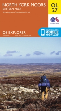
Add to BasketNorth York Moors - Eastern Area
Ordnance Survey
In StockFree UK DeliveryEstimated delivery 2-3 working days
Format: Book (Sheet map, folded)
£12.99
£10.72
In StockFree UK DeliveryEstimated delivery 2-3 working days
Book (Sheet map, folded)
Add to BasketKent and East Sussex Cycle Map 5 : Including the Southern most sections of Dover to Tain
In StockFree UK DeliveryEstimated delivery 2-3 working days
Format: Book (Sheet map, folded)
£8.99
£7.71
In StockFree UK DeliveryEstimated delivery 2-3 working days
Book (Sheet map, folded)
Add to BasketEast Anglia Cycle Map 13 : Including sections of The Varsity Way and Dover to Tain
In StockFree UK DeliveryEstimated delivery 2-3 working days
Format: Book (Sheet map, folded)
£8.99
£7.71
In StockFree UK DeliveryEstimated delivery 2-3 working days
Book (Sheet map, folded)
Add to BasketSomerset Levels and Dorset Downs Cycle Map 3 : Including The Wessex Cycleway and The Strawberry Line
In StockFree UK DeliveryEstimated delivery 2-3 working days
Format: Book (Sheet map, folded)
£8.99
£7.71
In StockFree UK DeliveryEstimated delivery 2-3 working days
Book (Sheet map, folded)
Add to BasketSouth Downs, The New Forest, and The Isle of Wight Cycle Map 4 : Including Avenue Verte and Dover to St Austell
In StockFree UK DeliveryEstimated delivery 2-3 working days
Format: Book (Sheet map, folded)
£8.99
£7.71
In StockFree UK DeliveryEstimated delivery 2-3 working days
Book (Sheet map, folded)
Add to BasketBad Ischl - Wolfgangsee - Hintersee - Altausseer See
In StockFree UK DeliveryEstimated delivery 2-3 working days
Format: Book (Sheet map, folded)
£10.99
£9.49
In StockFree UK DeliveryEstimated delivery 2-3 working days
Book (Sheet map, folded)
Add to BasketHannover cycling tour map : H1
In StockFree UK DeliveryEstimated delivery 2-3 working days
Format: Book (Sheet map, folded)
£8.99
£8.24
In StockFree UK DeliveryEstimated delivery 2-3 working days
Book (Sheet map, folded)
Add to Basket

