Imray Chart C57 : Tuskar Rock to Old Head of Kinsale
Imray
Out of StockMore expected soonContact us for further information
Format: Book (Sheet map)
£25.95
£24.40
Out of StockMore expected soonContact us for further information
Book (Sheet map)
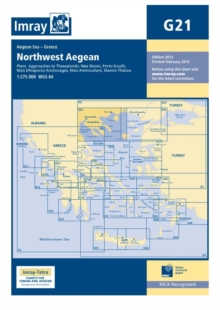
Add to BasketImray Chart G21 : Northwest Aegean Sea
Imray
Out of StockMore expected soonContact us for further information
Format: Book (Sheet map, folded)
£23.95
£21.81
Out of StockMore expected soonContact us for further information
Book (Sheet map, folded)
Add to BasketImray Chart Pack 2800 : Isle of Mull and Adjacent Coasts Chart Pack
Imray
Out of Stock - We are unable to provide an estimated availability date for this product
Format: Book (Sheet map, flat)
£51.99
Out of Stock - We are unable to provide an estimated availability date for this product
Book (Sheet map, flat)
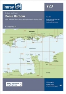
Add to BasketImray Chart Y23 : Poole Harbour
Imray
Out of StockMore expected soonContact us for further information
Format: Book (Sheet map, folded)
£25.29
Out of StockMore expected soonContact us for further information
Book (Sheet map, folded)
Add to BasketM9 South Sardegna
Imray
In StockFree UK DeliveryEstimated delivery 2-3 working days
Format: Book (Sheet map, folded)
£23.95
£22.86
In StockFree UK DeliveryEstimated delivery 2-3 working days
Book (Sheet map, folded)
Add to BasketImray Chart G36 Turkey - South Coast : Marmaris to Kekova Adasi
Imray
Out of StockMore expected soonContact us for further information
Format: Book (Sheet map, folded)
£25.68
Out of StockMore expected soonContact us for further information
Book (Sheet map, folded)
Add to BasketImary Chart A23 : Virgin Islands and St Croix
Imray
Out of StockMore expected soonContact us for further information
Format: Book (Sheet map, folded)
£23.95
£22.86
Out of StockMore expected soonContact us for further information
Book (Sheet map, folded)
Add to BasketImray Chart Y32 : Eastern Approach to the Solent (Small Format)
Imray
Out of StockMore expected soonContact us for further information
Format: Book (Sheet map, folded)
£18.23
Out of StockMore expected soonContact us for further information
Book (Sheet map, folded)
Add to BasketImray Chart C41 : Les Sables d'Olonne to La Gironde
Imray
Out of StockMore expected soonContact us for further information
Format: Book (Sheet map, folded)
£25.95
£24.40
Out of StockMore expected soonContact us for further information
Book (Sheet map, folded)
Add to BasketImray Chart Y36 : Central Solent (Small Format)
Imray
Out of StockMore expected soonContact us for further information
Format: Book (Sheet map, folded)
£18.23
Out of StockMore expected soonContact us for further information
Book (Sheet map, folded)
Add to BasketImray Chart C14 : Plymouth Harbour and Rivers
Imray
In StockFree UK DeliveryEstimated delivery 2-3 working days
Format: Book (Sheet map, folded)
£25.95
£24.40
In StockFree UK DeliveryEstimated delivery 2-3 working days
Book (Sheet map, folded)
Add to BasketImray Chart C37 : Raz de Sein to Benodet
Imray
Out of StockMore expected soonContact us for further information
Format: Book (Sheet map, folded)
£25.95
£24.40
Out of StockMore expected soonContact us for further information
Book (Sheet map, folded)
Add to BasketImray Chart A231 : Virgin Islands St Thomas to Virgin Gorda
Imray
Out of Stock - We are unable to provide an estimated availability date for this product
Format: Book (Sheet map, folded)
£21.95
£21.33
Out of Stock - We are unable to provide an estimated availability date for this product
Book (Sheet map, folded)
Add to BasketImray Chart Atlas 2110 : North France - Nord-Pas-de-Calais, Picardy and Normandy Coasts
Imray
Out of StockMore expected soonContact us for further information
Format: Book (Sheet map, flat)
£47.32
Out of StockMore expected soonContact us for further information
Book (Sheet map, flat)
Add to BasketImray Chart A28 : Guadeloupe
Imray
Out of StockMore expected soonContact us for further information
Format: Book (Sheet map, folded)
£23.95
£22.86
Out of StockMore expected soonContact us for further information
Book (Sheet map, folded)
Add to BasketImray Chart : Ijmuiden to Die Elbe
Imray
Out of Stock - We are unable to provide an estimated availability date for this product
Format: Book (Sheet map)
£21.95
£21.33
Out of Stock - We are unable to provide an estimated availability date for this product
Book (Sheet map)
Add to BasketImray Chart Y16 : Walton Backwaters to Ipswich and Woodbridge
Imray
In StockFree UK DeliveryEstimated delivery 2-3 working days
Format: Book (Sheet map, folded)
£23.50
£22.52
In StockFree UK DeliveryEstimated delivery 2-3 working days
Book (Sheet map, folded)
Add to BasketImray Chart G28 : Nisos Khios & the Coast of Turkey
Imray
In StockFree UK DeliveryEstimated delivery 2-3 working days
Format: Book (Sheet map, folded)
£23.95
£22.86
In StockFree UK DeliveryEstimated delivery 2-3 working days
Book (Sheet map, folded)
Add to BasketImray Chart E3 : Arquipelago da Madeira
Imray
Out of StockMore expected soonContact us for further information
Format: Book (Sheet map, folded)
£23.95
£22.86
Out of StockMore expected soonContact us for further information
Book (Sheet map, folded)
Add to BasketImray Chart Y49 : Isles of Scilly (Small Format)
Imray
In StockFree UK DeliveryEstimated delivery 2-3 working days
Format: Book (Sheet map, folded)
£18.84
In StockFree UK DeliveryEstimated delivery 2-3 working days
Book (Sheet map, folded)
Add to BasketImray Chart C59 : Bristol Channel
Imray
In StockFree UK DeliveryEstimated delivery 2-3 working days
Format: Book (Sheet map, folded)
£25.95
£24.40
In StockFree UK DeliveryEstimated delivery 2-3 working days
Book (Sheet map, folded)
Add to BasketImray Chart G22 : Northeast Aegean Sea
Imray Laurie Norie & Wilson Ltd
In StockFree UK DeliveryEstimated delivery 2-3 working days
Format: Book (Sheet map, folded)
£23.95
£22.86
In StockFree UK DeliveryEstimated delivery 2-3 working days
Book (Sheet map, folded)
Add to BasketImray Chart G27 : Nisos Lesvos & the Coast of Turkey
Imray
Out of StockMore expected soonContact us for further information
Format: Book (Sheet map, folded)
£23.95
£22.86
Out of StockMore expected soonContact us for further information
Book (Sheet map, folded)
Add to BasketImray Chart Y50 : Saint Mary's, Tresco and Surrounding Islands (Small Format)
Imray
Out of StockMore expected soonContact us for further information
Format: Book (Sheet map, folded)
£15.48
Out of StockMore expected soonContact us for further information
Book (Sheet map, folded)
Add to Basket


