Nicholson Inland Waterways Map of Great Britain : For Everyone with an Interest in Britain’s Canals and Rivers
Nicholson Waterways Guides
In StockFree UK DeliveryEstimated delivery 2-3 working days
Format: Book (Sheet map, folded)
£8.99
£8.45
In StockFree UK DeliveryEstimated delivery 2-3 working days
Book (Sheet map, folded)
Add to BasketKefalonia Tour and Trail Map
Jan Kostura
In StockFree UK DeliveryEstimated delivery 2-3 working days
Format: Book (Sheet map, folded)
£10.99
£9.48
In StockFree UK DeliveryEstimated delivery 2-3 working days
Book (Sheet map, folded)
Add to BasketImray Chart C34 : Cap d'Erquy to Ile de Batz
Imray
In StockFree UK DeliveryEstimated delivery 2-3 working days
Format: Book (Sheet map, folded)
£28.61
In StockFree UK DeliveryEstimated delivery 2-3 working days
Book (Sheet map, folded)
Add to BasketG3 Aegean Sea (South)
Rod & Lu Heikell
In StockFree UK DeliveryEstimated delivery 2-3 working days
Format: Book (Sheet map, folded)
£25.30
In StockFree UK DeliveryEstimated delivery 2-3 working days
Book (Sheet map, folded)
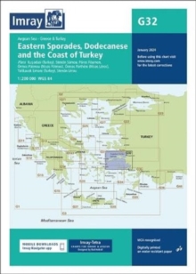
Add to BasketImray Chart G32 : Eastern Sporades, Dodecanese & the Coast of Turkey
Imray
In StockFree UK DeliveryEstimated delivery 2-3 working days
Format: Book (Sheet map, folded)
£25.30
In StockFree UK DeliveryEstimated delivery 2-3 working days
Book (Sheet map, folded)
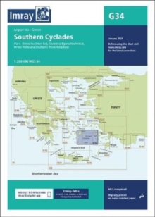
Add to BasketImray Chart G34 : Southern Cyclades
Imray
In StockFree UK DeliveryEstimated delivery 2-3 working days
Format: Book (Sheet map, folded)
£25.30
In StockFree UK DeliveryEstimated delivery 2-3 working days
Book (Sheet map, folded)
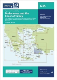
Add to BasketImray Chart G35 : Dodecanese and the Coast of Turkey
Imray
In StockFree UK DeliveryEstimated delivery 2-3 working days
Format: Book (Sheet map, folded)
£25.30
In StockFree UK DeliveryEstimated delivery 2-3 working days
Book (Sheet map, folded)
Add to BasketG1 Mainland Greece and the Peloponnisos : Passage Chart
In StockFree UK DeliveryEstimated delivery 2-3 working days
Format: Book (Sheet map, folded)
£25.30
In StockFree UK DeliveryEstimated delivery 2-3 working days
Book (Sheet map, folded)
Add to BasketImray Chart G15 : Southern Peloponnisos
Imray
In StockFree UK DeliveryEstimated delivery 2-3 working days
Format: Book (Sheet map, folded)
£25.30
In StockFree UK DeliveryEstimated delivery 2-3 working days
Book (Sheet map, folded)
Add to BasketImray Chart G16 : Western Peloponnisos
Imray
In StockFree UK DeliveryEstimated delivery 2-3 working days
Format: Book (Sheet map, folded)
£25.30
In StockFree UK DeliveryEstimated delivery 2-3 working days
Book (Sheet map, folded)
Add to BasketImray Chart C8 : Dover Strait
Imray
In StockFree UK DeliveryEstimated delivery 2-3 working days
Format: Book (Sheet map, folded)
£27.07
In StockFree UK DeliveryEstimated delivery 2-3 working days
Book (Sheet map, folded)
Add to BasketImray Chart C9 : Beachy Head to Isle of Wight
Imray
In StockFree UK DeliveryEstimated delivery 2-3 working days
Format: Book (Sheet map, folded)
£27.07
In StockFree UK DeliveryEstimated delivery 2-3 working days
Book (Sheet map, folded)
Add to BasketImray Chart Y18 : The River Medway and Approaches
Imray
In StockFree UK DeliveryEstimated delivery 2-3 working days
Format: Book (Sheet map, folded)
£24.91
In StockFree UK DeliveryEstimated delivery 2-3 working days
Book (Sheet map, folded)
Add to BasketImray Chart C2 : The River Thames
Imray
In StockFree UK DeliveryEstimated delivery 2-3 working days
Format: Book (Sheet map, folded)
£27.07
In StockFree UK DeliveryEstimated delivery 2-3 working days
Book (Sheet map, folded)
Add to BasketKent and East Sussex Cycle Map 5 : Including the Southern most sections of Dover to Tain
In StockFree UK DeliveryEstimated delivery 2-3 working days
Format: Book (Sheet map, folded)
£8.99
£7.71
In StockFree UK DeliveryEstimated delivery 2-3 working days
Book (Sheet map, folded)
Add to BasketNorth and South Devon Cycle Map 2 : Including the Devon Coast to coast and The Dartmoor Way
In StockFree UK DeliveryEstimated delivery 2-3 working days
Format: Book (Sheet map, folded)
£8.99
£7.71
In StockFree UK DeliveryEstimated delivery 2-3 working days
Book (Sheet map, folded)
Add to BasketSomerset Levels and Dorset Downs Cycle Map 3 : Including The Wessex Cycleway and The Strawberry Line
In StockFree UK DeliveryEstimated delivery 2-3 working days
Format: Book (Sheet map, folded)
£8.99
£7.71
In StockFree UK DeliveryEstimated delivery 2-3 working days
Book (Sheet map, folded)
Add to BasketSouth Downs, The New Forest, and The Isle of Wight Cycle Map 4 : Including Avenue Verte and Dover to St Austell
In StockFree UK DeliveryEstimated delivery 2-3 working days
Format: Book (Sheet map, folded)
£8.99
£7.71
In StockFree UK DeliveryEstimated delivery 2-3 working days
Book (Sheet map, folded)
Add to BasketExo Mani (8.10) Hiking Map
Out of StockMore expected soonContact us for further information
Format: Book (Sheet map, folded)
£9.50
£8.73
Out of StockMore expected soonContact us for further information
Book (Sheet map, folded)
Add to BasketImray Chart C52 : Cardigan Bay to Liverpool
Imray
In StockFree UK DeliveryEstimated delivery 2-3 working days
Format: Book (Sheet map, folded)
£28.61
In StockFree UK DeliveryEstimated delivery 2-3 working days
Book (Sheet map, folded)
Add to BasketAppalachian Trail
Out of StockMore expected soonContact us for further information
Format: Book (Sheet map, folded)
£10.00
£9.31
Out of StockMore expected soonContact us for further information
Book (Sheet map, folded)
Add to BasketArdeche - Privas Aubenas Vallon-Pont-d'Arc : D07
Out of StockMore expected soonContact us for further information
Format: Book (Sheet map, folded)
£9.80
£9.42
Out of StockMore expected soonContact us for further information
Book (Sheet map, folded)
Add to BasketAin - Bourg-en-Bresse Amberieu-en-Bugey Pays de Gex : D01
Out of StockMore expected soonContact us for further information
Format: Book (Sheet map, folded)
£9.80
£9.42
Out of StockMore expected soonContact us for further information
Book (Sheet map, folded)
Add to BasketJura - Pays de Dole Val d'Amour Champagnole Rousses : D39
Out of StockMore expected soonContact us for further information
Format: Book (Sheet map, folded)
£9.80
£9.42
Out of StockMore expected soonContact us for further information
Book (Sheet map, folded)
Add to Basket


