Wakefield (West) 1905 : Yorkshire Sheet 248.06
Alan Godfrey
In StockFree UK DeliveryEstimated delivery 2-3 working days
Format: Book (Sheet map, folded)
£4.76
In StockFree UK DeliveryEstimated delivery 2-3 working days
Book (Sheet map, folded)
Add to BasketLiverpool (North) 1890: Lancashire Sheet 106.10A : Coloured Edition
Kay Parrott
In StockFree UK DeliveryEstimated delivery 2-3 working days
Format: Book (Sheet map, folded)
£5.04
In StockFree UK DeliveryEstimated delivery 2-3 working days
Book (Sheet map, folded)
Add to BasketGlasgow (St Rollox) 1933 : Lanarkshire Sheet 6.07
Gilbert Torrance Bell
In StockFree UK DeliveryEstimated delivery 2-3 working days
Format: Book (Sheet map, folded)
£4.76
In StockFree UK DeliveryEstimated delivery 2-3 working days
Book (Sheet map, folded)
Add to BasketRamsgate 1905 : Kent Sheet 38.01
Barrie Trinder
In StockFree UK DeliveryEstimated delivery 2-3 working days
Format: Book (Sheet map, folded)
£4.76
In StockFree UK DeliveryEstimated delivery 2-3 working days
Book (Sheet map, folded)
Add to BasketMiddlesbrough (North) 1893 : Yorkshire Sheet 6.10a
Robert Woodhouse
In StockFree UK DeliveryEstimated delivery 2-3 working days
Format: Book (Sheet map, folded)
£5.04
In StockFree UK DeliveryEstimated delivery 2-3 working days
Book (Sheet map, folded)
Add to BasketNorth Chadderton and SW Royton 1932 : Lancashire Sheet 97.01
Alan Godfrey
In StockFree UK DeliveryEstimated delivery 2-3 working days
Format: Book (Sheet map, folded)
£4.76
In StockFree UK DeliveryEstimated delivery 2-3 working days
Book (Sheet map, folded)
Add to BasketLiverpool (Wapping) 1849-64 : Liverpool Sheet 34
Kay Parrott
In StockFree UK DeliveryEstimated delivery 2-3 working days
Format: Book (Sheet map, folded)
£4.76
In StockFree UK DeliveryEstimated delivery 2-3 working days
Book (Sheet map, folded)
Add to BasketPaisley 1858 : Renfrewshire Sheet 12.02a
Gilbert Bell
In StockFree UK DeliveryEstimated delivery 2-3 working days
Format: Book (Sheet map, folded)
£5.04
In StockFree UK DeliveryEstimated delivery 2-3 working days
Book (Sheet map, folded)
Add to BasketAn Historical Map of Swansea & Mumbles : medieval town to Copperopolis
Matthew Stevens
In StockFree UK DeliveryEstimated delivery 2-3 working days
Format: Book (Sheet map, folded)
£10.99
£9.12
In StockFree UK DeliveryEstimated delivery 2-3 working days
Book (Sheet map, folded)
Add to BasketMacclesfield (South) 1897 : Cheshire Sheet 36.12
Chris Makepeace
In StockFree UK DeliveryEstimated delivery 2-3 working days
Format: Book (Sheet map, folded)
£6.24
In StockFree UK DeliveryEstimated delivery 2-3 working days
Book (Sheet map, folded)
Add to BasketLeeds (NW) 1889 : Yorkshire Sheet 218.01
Alan Godfrey
In StockFree UK DeliveryEstimated delivery 2-3 working days
Format: Book (Sheet map, folded)
£5.04
In StockFree UK DeliveryEstimated delivery 2-3 working days
Book (Sheet map, folded)
Add to BasketHull (East) 1890 : Yorkshire Sheet 240.03
Susan Neave
In StockFree UK DeliveryEstimated delivery 2-3 working days
Format: Book (Sheet map, folded)
£5.04
In StockFree UK DeliveryEstimated delivery 2-3 working days
Book (Sheet map, folded)
Add to BasketHuyton 1906 : Lancashire Sheet 107.10
Kay Parrott
In StockFree UK DeliveryEstimated delivery 2-3 working days
Format: Book (Sheet map, folded)
£4.76
In StockFree UK DeliveryEstimated delivery 2-3 working days
Book (Sheet map, folded)
Add to BasketHeywood 1907 : Lancashire Sheet 88.11
Paul Hindle
In StockFree UK DeliveryEstimated delivery 2-3 working days
Format: Book (Sheet map, folded)
£4.76
In StockFree UK DeliveryEstimated delivery 2-3 working days
Book (Sheet map, folded)
Add to BasketBirmingham (South) 1888 : Warwickshire Sheet 14.09a
Malcolm Nixon
In StockFree UK DeliveryEstimated delivery 2-3 working days
Format: Book (Sheet map, folded)
£4.76
In StockFree UK DeliveryEstimated delivery 2-3 working days
Book (Sheet map, folded)
Add to BasketChildwall & Court Hey 1906 : Lancashire Sheet 107.13
Kay Parrott
In StockFree UK DeliveryEstimated delivery 2-3 working days
Format: Book (Sheet map, folded)
£4.76
In StockFree UK DeliveryEstimated delivery 2-3 working days
Book (Sheet map, folded)
Add to BasketHunslet 1890 : Yorkshire Sheet 218.10
Gordon Dickinson
In StockFree UK DeliveryEstimated delivery 2-3 working days
Format: Book (Sheet map, folded)
£4.76
In StockFree UK DeliveryEstimated delivery 2-3 working days
Book (Sheet map, folded)
Add to BasketA Bristol 1851-1903 - Fold up Map that consists of Four Detailed Street Plans, Bristol 1851 by John Tallis, 1866 by A Fullarton, 1893 by William MacKenzie and 1903 by Bartholomew.
Mapseeker Publishing Ltd.
In StockFree UK DeliveryEstimated delivery 2-3 working days
Format: Book (Sheet map, folded)
£19.99
£17.03
In StockFree UK DeliveryEstimated delivery 2-3 working days
Book (Sheet map, folded)
Add to BasketThe Secret City : A Spy’s Guide To London
Richard Hutt
In StockFree UK DeliveryEstimated delivery 2-3 working days
Format: Book (Sheet map, folded)
£12.00
£10.30
In StockFree UK DeliveryEstimated delivery 2-3 working days
Book (Sheet map, folded)
Add to BasketA Oxfordshire 1611 - 1836 - Fold Up Map that features a collection of Four Historic Maps, John Speed's County Map 1611, Johan Blaeu's County Map of 1648, Thomas Moules County Map of 1836 and a Plan of
Mapseeker Publishing Ltd.
In StockFree UK DeliveryEstimated delivery 2-3 working days
Format: Book (Sheet map, folded)
£19.99
£17.03
In StockFree UK DeliveryEstimated delivery 2-3 working days
Book (Sheet map, folded)
Add to BasketCambridgeshire 1611 - 1836 - Fold Up Map that includes Four Historic Maps of Cambridgeshire, John Speed's County Map of 1611, Johan Blaeu's County Map of 1648, Thomas Moule's County Map of 1836 and Th
Mapseeker Publishing Ltd.
In StockFree UK DeliveryEstimated delivery 2-3 working days
Format: Book (Sheet map, folded)
£19.99
£17.03
In StockFree UK DeliveryEstimated delivery 2-3 working days
Book (Sheet map, folded)
Add to BasketEdgbaston 1887 : Warwickshire Sheet 13.12a
Malcolm Nixon
In StockFree UK DeliveryEstimated delivery 2-3 working days
Format: Book (Sheet map, folded)
£5.04
In StockFree UK DeliveryEstimated delivery 2-3 working days
Book (Sheet map, folded)
Add to BasketHistorical Maps of Alnwick & Alnmouth from Earliest Times to 1918
Drawn from Alnwick's Heritage Societies
In StockFree UK DeliveryEstimated delivery 2-3 working days
Format: Book (Sheet map)
£9.99
£8.45
In StockFree UK DeliveryEstimated delivery 2-3 working days
Book (Sheet map)
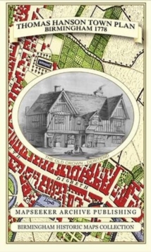
Add to BasketThomas Hanson Town Plan of Birmingham 1778
Thomas Hanson
In StockFree UK DeliveryEstimated delivery 2-3 working days
Format: Book (Sheet map, folded)
£19.99
£17.03
In StockFree UK DeliveryEstimated delivery 2-3 working days
Book (Sheet map, folded)
Add to Basket