Imray Chart Pack 3200 : Islas Baleares Wiro Bound
Imray
Out of StockMore expected soonContact us for further information
Format: Book (Spiral bound)
£61.48
Out of StockMore expected soonContact us for further information
Book (Spiral bound)
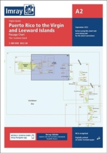
Add to BasketImray Chart A2 : Puerto Rico to the Virgin and Leeward Islands
Imray
In StockFree UK DeliveryEstimated delivery 2-3 working days
Format: Book (Sheet map, folded)
£27.10
In StockFree UK DeliveryEstimated delivery 2-3 working days
Book (Sheet map, folded)
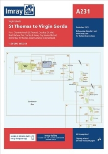
Add to BasketImray Chart A231 : St Thomas to Virgin Gorda
Imray
In StockFree UK DeliveryEstimated delivery 2-3 working days
Format: Book (Sheet map, folded)
£27.10
In StockFree UK DeliveryEstimated delivery 2-3 working days
Book (Sheet map, folded)
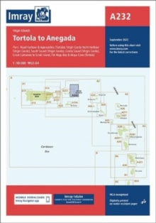
Add to BasketImray Chart A232 : Tortola to Anegada
Imray
In StockFree UK DeliveryEstimated delivery 2-3 working days
Format: Book (Sheet map, folded)
£27.10
In StockFree UK DeliveryEstimated delivery 2-3 working days
Book (Sheet map, folded)
Add to BasketImray Chart M14 : Barcelona to Bouches du Rhone
Imray
In StockFree UK DeliveryEstimated delivery 2-3 working days
Format: Book (Sheet map)
Map of the River Thames
Imray
Out of StockMore expected soonContact us for further information
Format: Book (Sheet map, folded)
£11.66
Out of StockMore expected soonContact us for further information
Book (Sheet map, folded)
Add to BasketG3 Aegean Sea (South)
Imray
Out of StockMore expected soonContact us for further information
Format: Book (Sheet map, folded)
£23.95
£22.86
Out of StockMore expected soonContact us for further information
Book (Sheet map, folded)
Add to BasketArdnamurchan to Cape Wrath : Clyde Cruising Club Sailing Directions & Anchorages
Imray
Out of StockMore expected soonContact us for further information
Format: Book (Spiral bound)
£37.50
£33.26
Out of StockMore expected soonContact us for further information
Book (Spiral bound)
Add to BasketImray Chart G11 : North Ionian Islands
Imray
Out of StockMore expected soonContact us for further information
Format: Book (Sheet map, folded)
£23.95
£22.86
Out of StockMore expected soonContact us for further information
Book (Sheet map, folded)
Add to BasketImray Chart C67 : North Minch and Isle of Lewis
Imray
Out of StockMore expected soonContact us for further information
Format: Book (Sheet map, folded)
£25.95
£24.40
Out of StockMore expected soonContact us for further information
Book (Sheet map, folded)
Add to BasketImray Chart C62 : Irish Sea
Imray
Out of StockMore expected soonContact us for further information
Format: Book (Sheet map, folded)
£25.95
£24.40
Out of StockMore expected soonContact us for further information
Book (Sheet map, folded)
Add to BasketImray Chart C15 : Bembridge to Hurst Point and Southampton
Imray
Out of StockMore expected soonContact us for further information
Format: Book (Sheet map, folded)
£25.95
£24.40
Out of StockMore expected soonContact us for further information
Book (Sheet map, folded)
Add to BasketImray Chart Atlas 2600 : Bristol Channel
Imray
Out of Stock - We are unable to provide an estimated availability date for this product
Format: Book (Sheet map, flat)
£54.45
Out of Stock - We are unable to provide an estimated availability date for this product
Book (Sheet map, flat)
Add to BasketC80 British Isles
Imray
Out of StockMore expected soonContact us for further information
Format: Book (Sheet map, folded)
£25.95
£24.40
Out of StockMore expected soonContact us for further information
Book (Sheet map, folded)
Add to BasketG2 Aegean Sea (North) : Passage Chart
Imray
Out of StockMore expected soonContact us for further information
Format: Book (Sheet map, folded)
£23.95
£22.86
Out of StockMore expected soonContact us for further information
Book (Sheet map, folded)
Add to BasketImray Chart Pack 2800 : Isle of Mull and Adjacent Coasts Chart Pack
Imray
Out of Stock - We are unable to provide an estimated availability date for this product
Format: Book (Sheet map, flat)
£51.99
Out of Stock - We are unable to provide an estimated availability date for this product
Book (Sheet map, flat)
Add to BasketImray Chart Y32 : Eastern Approach to the Solent (Small Format)
Imray
Out of StockMore expected soonContact us for further information
Format: Book (Sheet map, folded)
£18.23
Out of StockMore expected soonContact us for further information
Book (Sheet map, folded)
Add to BasketImray Chart C14 : Plymouth Harbour and Rivers
Imray
Out of StockMore expected soonContact us for further information
Format: Book (Sheet map, folded)
£25.95
£24.40
Out of StockMore expected soonContact us for further information
Book (Sheet map, folded)
Add to BasketImray Chart Y36 : Central Solent (Small Format)
Imray
Out of StockMore expected soonContact us for further information
Format: Book (Sheet map, folded)
£18.23
Out of StockMore expected soonContact us for further information
Book (Sheet map, folded)
Add to BasketImray Chart C41 : Les Sables d'Olonne to La Gironde
Imray
Out of StockMore expected soonContact us for further information
Format: Book (Sheet map, folded)
£25.95
£24.40
Out of StockMore expected soonContact us for further information
Book (Sheet map, folded)
Add to BasketImray Chart A231 : Virgin Islands St Thomas to Virgin Gorda
Imray
Out of Stock - We are unable to provide an estimated availability date for this product
Format: Book (Sheet map, folded)
£21.95
£21.33
Out of Stock - We are unable to provide an estimated availability date for this product
Book (Sheet map, folded)
Add to BasketImray Chart C37 : Raz de Sein to Benodet
Imray
Out of StockMore expected soonContact us for further information
Format: Book (Sheet map, folded)
£25.95
£24.40
Out of StockMore expected soonContact us for further information
Book (Sheet map, folded)
Add to BasketImray Chart Atlas 2110 : North France - Nord-Pas-de-Calais, Picardy and Normandy Coasts
Imray
Out of StockMore expected soonContact us for further information
Format: Book (Sheet map, flat)
£47.32
Out of StockMore expected soonContact us for further information
Book (Sheet map, flat)
Add to BasketImray Chart A28 : Guadeloupe
Imray
Out of StockMore expected soonContact us for further information
Format: Book (Sheet map, folded)
£23.95
£22.86
Out of StockMore expected soonContact us for further information
Book (Sheet map, folded)
Add to Basket


