G12 South Ionian Islands : Nisos Levkas to Nisos Zakinthos
Imray
In StockFree UK DeliveryEstimated delivery 2-3 working days
Format: Book (Sheet map, folded)
£25.68
In StockFree UK DeliveryEstimated delivery 2-3 working days
Book (Sheet map, folded)
Add to BasketG3 Aegean Sea (South)
Rod & Lu Heikell
In StockFree UK DeliveryEstimated delivery 2-3 working days
Format: Book (Sheet map, folded)
£25.68
In StockFree UK DeliveryEstimated delivery 2-3 working days
Book (Sheet map, folded)
Add to BasketG1 Mainland Greece and the Peloponnisos : Passage Chart
In StockFree UK DeliveryEstimated delivery 2-3 working days
Format: Book (Sheet map, folded)
£25.68
In StockFree UK DeliveryEstimated delivery 2-3 working days
Book (Sheet map, folded)
Add to BasketImray Chart A233 : Virgin Islands
Imray
In StockFree UK DeliveryEstimated delivery 2-3 working days
Format: Book (Sheet map, folded)
£35.59
In StockFree UK DeliveryEstimated delivery 2-3 working days
Book (Sheet map, folded)
Add to BasketCornwall Pocket Map : The Perfect Way to Explore Cornwall
Collins Maps
In StockFree UK DeliveryEstimated delivery 2-3 working days
Format: Book (Sheet map, folded)
£5.04
In StockFree UK DeliveryEstimated delivery 2-3 working days
Book (Sheet map, folded)
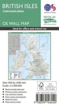
Add to BasketBritish Isles Communication
In StockFree UK DeliveryEstimated delivery 2-3 working days
Format: Book (Sheet map, rolled)
£11.99
£11.17
In StockFree UK DeliveryEstimated delivery 2-3 working days
Book (Sheet map, rolled)
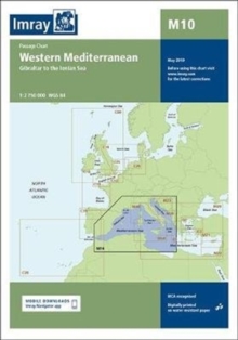
Add to BasketImray Chart M10 : Western Mediterranean
Imray
In StockFree UK DeliveryEstimated delivery 2-3 working days
Format: Book (Sheet map, folded)
£23.95
£22.86
In StockFree UK DeliveryEstimated delivery 2-3 working days
Book (Sheet map, folded)
Add to BasketTour du Mont Blanc : Easy-to-use folding map and essential information, with custom itinerary planning for walkers, trekkers, fastpackers and trail runners
In StockFree UK DeliveryEstimated delivery 2-3 working days
Format: Book (Sheet map, folded)
£14.95
£11.14
In StockFree UK DeliveryEstimated delivery 2-3 working days
Book (Sheet map, folded)
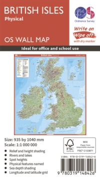
Add to BasketBritish Isles Physical
Ordnance Survey
In StockFree UK DeliveryEstimated delivery 2-3 working days
Format: Book (Sheet map, rolled)
£11.99
£11.17
In StockFree UK DeliveryEstimated delivery 2-3 working days
Book (Sheet map, rolled)
Add to BasketImray Chart G25 : Northern Sporades and North Evvoia
Imray
In StockFree UK DeliveryEstimated delivery 2-3 working days
Format: Book (Sheet map, folded)
£23.95
£22.86
In StockFree UK DeliveryEstimated delivery 2-3 working days
Book (Sheet map, folded)
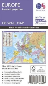
Add to BasketEurope : Lambert projection
In StockFree UK DeliveryEstimated delivery 2-3 working days
Format: Book (Sheet map, rolled)
£11.99
£11.17
In StockFree UK DeliveryEstimated delivery 2-3 working days
Book (Sheet map, rolled)
Add to BasketImray Chart C24 : Flamborough Head to Fife Ness
Imray
In StockFree UK DeliveryEstimated delivery 2-3 working days
Format: Book (Sheet map, folded)
£25.95
£24.40
In StockFree UK DeliveryEstimated delivery 2-3 working days
Book (Sheet map, folded)
Add to BasketWINDSOR GREAT PARK FOOTPATH MAP
In StockFree UK DeliveryEstimated delivery 2-3 working days
Format: Book (Sheet map)
Imray Chart C42 : La Rochelle to Santander
Imray
In StockFree UK DeliveryEstimated delivery 2-3 working days
Format: Book (Sheet map, folded)
£25.95
£24.40
In StockFree UK DeliveryEstimated delivery 2-3 working days
Book (Sheet map, folded)
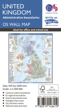
Add to BasketUnited Kingdom Administrative Boundaries
Ordnance Survey
In StockFree UK DeliveryEstimated delivery 2-3 working days
Format: Book (Sheet map, rolled)
£11.99
£11.17
In StockFree UK DeliveryEstimated delivery 2-3 working days
Book (Sheet map, rolled)
Add to BasketResort Map of the Maldives
Tim Godfrey
In StockFree UK DeliveryEstimated delivery 2-3 working days
Format: Book (Sheet map, folded)
£13.69
In StockFree UK DeliveryEstimated delivery 2-3 working days
Book (Sheet map, folded)
Add to BasketImray Chart M23 Adriatic Sea Passage Chart : Golfo di Trieste to Bar and Promontorio del Gargano
Imray
In StockFree UK DeliveryEstimated delivery 2-3 working days
Format: Book (Sheet map, folded)
£23.95
£22.86
In StockFree UK DeliveryEstimated delivery 2-3 working days
Book (Sheet map, folded)
Add to BasketImray Chart C39 : Lorient to Le Croisic
Imray
In StockFree UK DeliveryEstimated delivery 2-3 working days
Format: Book (Sheet map, folded)
£25.95
£24.40
In StockFree UK DeliveryEstimated delivery 2-3 working days
Book (Sheet map, folded)
Add to BasketImray Chart M27 : Dubrovnik to Bar and Ulcinj
Imray
In StockFree UK DeliveryEstimated delivery 2-3 working days
Format: Book (Sheet map, folded)
£23.95
£22.86
In StockFree UK DeliveryEstimated delivery 2-3 working days
Book (Sheet map, folded)
Add to BasketImray Chart E2 : Islas Canarias
Imray
In StockFree UK DeliveryEstimated delivery 2-3 working days
Format: Book (Sheet map, folded)
£23.95
£22.86
In StockFree UK DeliveryEstimated delivery 2-3 working days
Book (Sheet map, folded)
Add to BasketImray Chart M46 : Isole Pontine to the Bay of Naples
Imray
In StockFree UK DeliveryEstimated delivery 2-3 working days
Format: Book (Sheet map, folded)
£23.95
£22.86
In StockFree UK DeliveryEstimated delivery 2-3 working days
Book (Sheet map, folded)
Add to BasketImray Chart C49 : Ria de Aveiro to Sines - Atlantic Coast of Portugal
Imray
In StockFree UK DeliveryEstimated delivery 2-3 working days
Format: Book (Sheet map, folded)
£25.95
£24.40
In StockFree UK DeliveryEstimated delivery 2-3 working days
Book (Sheet map, folded)
Add to BasketImray Chart C36 : Ile d'Ouessant to Raz de Seine
Imray
In StockFree UK DeliveryEstimated delivery 2-3 working days
Format: Book (Sheet map, folded)
£25.95
£24.40
In StockFree UK DeliveryEstimated delivery 2-3 working days
Book (Sheet map, folded)
Add to BasketImray Chart G36 Turkey - South Coast : Marmaris to Kekova Adasi
Imray
In StockFree UK DeliveryEstimated delivery 2-3 working days
Format: Book (Sheet map, folded)
£25.68
In StockFree UK DeliveryEstimated delivery 2-3 working days
Book (Sheet map, folded)
Add to Basket


