G12 South Ionian Islands : Nisos Levkas to Nisos Zakinthos
Imray
In StockFree UK DeliveryEstimated delivery 2-3 working days
Format: Book (Sheet map, folded)
£25.30
In StockFree UK DeliveryEstimated delivery 2-3 working days
Book (Sheet map, folded)
Add to BasketOn-Board Guide: Electrical Safety for Small Craft : An IET Guide covering the safety of DC and AC electrical systems in small craft navigating on UK inland waterways and surrounding sea areas
The Institution of Engineering and Technology
In StockFree UK DeliveryEstimated delivery 2-3 working days
Format: Book (Spiral bound)
£30.00
£26.89
In StockFree UK DeliveryEstimated delivery 2-3 working days
Book (Spiral bound)
Add to BasketG3 Aegean Sea (South)
Rod & Lu Heikell
In StockFree UK DeliveryEstimated delivery 2-3 working days
Format: Book (Sheet map, folded)
£25.30
In StockFree UK DeliveryEstimated delivery 2-3 working days
Book (Sheet map, folded)
Add to BasketG1 Mainland Greece and the Peloponnisos : Passage Chart
In StockFree UK DeliveryEstimated delivery 2-3 working days
Format: Book (Sheet map, folded)
£25.30
In StockFree UK DeliveryEstimated delivery 2-3 working days
Book (Sheet map, folded)
Add to BasketG2 Aegean Sea (North) : Passage Chart
Rod & Lu Heikell
In StockFree UK DeliveryEstimated delivery 2-3 working days
Format: Book (Fold-out book or chart)
£25.30
In StockFree UK DeliveryEstimated delivery 2-3 working days
Book (Fold-out book or chart)
Add to BasketImray Chart C51 Cardigan Bay : Milford Haven to Tremadog Bay
Imray
In StockFree UK DeliveryEstimated delivery 2-3 working days
Format: Book (Sheet map, folded)
£28.61
In StockFree UK DeliveryEstimated delivery 2-3 working days
Book (Sheet map, folded)
Add to BasketCCC Sailing Directions and Anchorages - Firth of Clyde : Including Solway Firth and North Channel
Geoff Clyde Cruising Club
In StockFree UK DeliveryEstimated delivery 2-3 working days
Format: Book (Spiral bound)
£37.50
£32.93
In StockFree UK DeliveryEstimated delivery 2-3 working days
Book (Spiral bound)
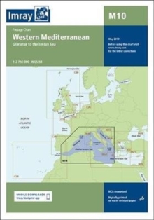
Add to BasketImray Chart M10 : Western Mediterranean
Imray
In StockFree UK DeliveryEstimated delivery 2-3 working days
Format: Book (Sheet map, folded)
£23.95
£22.49
In StockFree UK DeliveryEstimated delivery 2-3 working days
Book (Sheet map, folded)
Add to BasketCCC Sailing Directions - Kintyre to Ardnamurchan : Clyde Cruising Club Sailing Directions and Anchorages
Imray
In StockFree UK DeliveryEstimated delivery 2-3 working days
Format: Book (Spiral bound)
£37.50
£32.93
In StockFree UK DeliveryEstimated delivery 2-3 working days
Book (Spiral bound)
Add to BasketPhilip's Navigator Trucker's Britain: Spiral
Philip's Maps
In StockFree UK DeliveryEstimated delivery 2-3 working days
Format: Book (Spiral bound)
£26.99
£20.06
In StockFree UK DeliveryEstimated delivery 2-3 working days
Book (Spiral bound)
Add to BasketImray Chart : Sines to Gibraltar
In StockFree UK DeliveryEstimated delivery 2-3 working days
Format: Book (Sheet map)
£25.95
£24.02
In StockFree UK DeliveryEstimated delivery 2-3 working days
Book (Sheet map)
Add to BasketArdnamurchan to Cape Wrath : Clyde Cruising Club Sailing Directions & Anchorages
Imray
In StockFree UK DeliveryEstimated delivery 2-3 working days
Format: Book (Spiral bound)
£37.50
£32.93
In StockFree UK DeliveryEstimated delivery 2-3 working days
Book (Spiral bound)
Add to BasketImray Chart M40 : Ligurian and Tyrrhenian Sea
Imray
In StockFree UK DeliveryEstimated delivery 2-3 working days
Format: Book (Sheet map, folded)
£23.95
£22.49
In StockFree UK DeliveryEstimated delivery 2-3 working days
Book (Sheet map, folded)
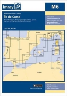
Add to BasketImray Chart M6 : Ile de Corse
Imray
In StockFree UK DeliveryEstimated delivery 2-3 working days
Format: Book (Sheet map, folded)
£23.95
£22.49
In StockFree UK DeliveryEstimated delivery 2-3 working days
Book (Sheet map, folded)
Add to BasketImray Chart G11 : North Ionian Islands
Imray
In StockFree UK DeliveryEstimated delivery 2-3 working days
Format: Book (Sheet map, folded)
£23.95
£22.49
In StockFree UK DeliveryEstimated delivery 2-3 working days
Book (Sheet map, folded)
Add to BasketImray Crossing the Thames Estuary : 3
Roger Imray
In StockFree UK DeliveryEstimated delivery 2-3 working days
Format: Book (Spiral bound)
£29.50
£26.74
In StockFree UK DeliveryEstimated delivery 2-3 working days
Book (Spiral bound)
Add to BasketImray Chart G25 : Northern Sporades and North Evvoia
Imray
In StockFree UK DeliveryEstimated delivery 2-3 working days
Format: Book (Sheet map, folded)
£23.95
£22.49
In StockFree UK DeliveryEstimated delivery 2-3 working days
Book (Sheet map, folded)
Add to BasketCCC Sailing Directions Orkney and Shetland Islands : Including North and Northeast Scotland
Iain Imray
In StockFree UK DeliveryEstimated delivery 2-3 working days
Format: Book (Spiral bound)
£37.50
£32.93
In StockFree UK DeliveryEstimated delivery 2-3 working days
Book (Spiral bound)
Add to BasketImray Chart M8 : North Sardegna
Imray
In StockFree UK DeliveryEstimated delivery 2-3 working days
Format: Book (Sheet map, folded)
£23.95
£22.49
In StockFree UK DeliveryEstimated delivery 2-3 working days
Book (Sheet map, folded)
Add to BasketC18 Western Approaches to the English Channel & Bay of Biscay : Passage Chart
IMRAY
In StockFree UK DeliveryEstimated delivery 2-3 working days
Format: Book (Sheet map, folded)
£25.95
£24.02
In StockFree UK DeliveryEstimated delivery 2-3 working days
Book (Sheet map, folded)
Add to BasketImray Chart C24 : Flamborough Head to Fife Ness
Imray
In StockFree UK DeliveryEstimated delivery 2-3 working days
Format: Book (Sheet map, folded)
£25.95
£24.02
In StockFree UK DeliveryEstimated delivery 2-3 working days
Book (Sheet map, folded)
Add to BasketImray Chart C56 : Cork Harbour to Dingle Bay
Imray
In StockFree UK DeliveryEstimated delivery 2-3 working days
Format: Book (Sheet map, folded)
£25.95
£24.02
In StockFree UK DeliveryEstimated delivery 2-3 working days
Book (Sheet map, folded)
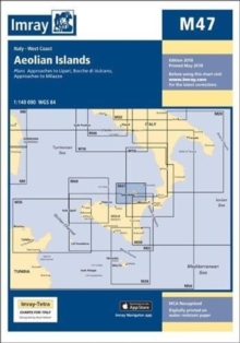
Add to BasketImray Chart M47 : Aeolian Islands
Imray Laurie Norie & Wilson Ltd
In StockFree UK DeliveryEstimated delivery 2-3 working days
Format: Book (Sheet map, folded)
£23.95
£22.49
In StockFree UK DeliveryEstimated delivery 2-3 working days
Book (Sheet map, folded)
Add to BasketImray Chart C62 : Irish Sea
Imray
In StockFree UK DeliveryEstimated delivery 2-3 working days
Format: Book (Sheet map, folded)
£25.95
£24.02
In StockFree UK DeliveryEstimated delivery 2-3 working days
Book (Sheet map, folded)
Add to Basket


