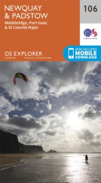
Newquay and Padstow
Ordnance Survey
In StockFree UK DeliveryEstimated delivery 2-3 working days
Format: Book (Sheet map, folded)
£12.99
£10.77
In StockFree UK DeliveryEstimated delivery 2-3 working days
Book (Sheet map, folded)
Add to BasketThe Peak District : Dark Peak Area
In StockFree UK DeliveryEstimated delivery 2-3 working days
Format: Book (Sheet map, folded)
£12.99
£10.77
In StockFree UK DeliveryEstimated delivery 2-3 working days
Book (Sheet map, folded)
Add to BasketThe English Lakes South-Eastern Area : Windermere, Kendal & Silverdale
In StockFree UK DeliveryEstimated delivery 2-3 working days
Format: Book (Sheet map, folded)
£12.99
£11.30
In StockFree UK DeliveryEstimated delivery 2-3 working days
Book (Sheet map, folded)
Add to BasketNorfolk Coast East
Ordnance Survey
In StockFree UK DeliveryEstimated delivery 2-3 working days
Format: Book (Sheet map, folded)
£12.99
£10.77
In StockFree UK DeliveryEstimated delivery 2-3 working days
Book (Sheet map, folded)
Add to BasketExmoor, Barnstaple, Lynton, Minehead & Dulverton
Ordnance Survey
In StockFree UK DeliveryEstimated delivery 2-3 working days
Format: Book (Sheet map, folded)
£12.99
£10.77
In StockFree UK DeliveryEstimated delivery 2-3 working days
Book (Sheet map, folded)
Add to BasketMarlborough and Savernake Forest
Ordnance Survey
In StockFree UK DeliveryEstimated delivery 2-3 working days
Format: Book (Sheet map, folded)
£12.99
£10.77
In StockFree UK DeliveryEstimated delivery 2-3 working days
Book (Sheet map, folded)
Add to BasketBrecon Beacons National Park / Parc Cenedlaethol Bannau Brycheiniog - Eastern Area / Ardal Ddwyreiniol
Ordnance Survey
In StockFree UK DeliveryEstimated delivery 2-3 working days
Format: Book (Sheet map, folded)
£12.99
£10.77
In StockFree UK DeliveryEstimated delivery 2-3 working days
Book (Sheet map, folded)
Add to BasketWanderlust Europe : The Great European Hike
Alex Roddie
In StockFree UK DeliveryEstimated delivery 2-3 working days
Format: Book (Hardback)
£40.00
£27.79
In StockFree UK DeliveryEstimated delivery 2-3 working days
Book (Hardback)
Add to BasketScarborough, Bridlington and Flamborough Head
Ordnance Survey
In StockFree UK DeliveryEstimated delivery 2-3 working days
Format: Book (Sheet map, folded)
£12.99
£10.77
In StockFree UK DeliveryEstimated delivery 2-3 working days
Book (Sheet map, folded)
Add to Basket20 Sussex Walks
Pat Bowen
In StockFree UK DeliveryEstimated delivery 2-3 working days
Format: Book (Hardback)
£8.99
£7.68
In StockFree UK DeliveryEstimated delivery 2-3 working days
Book (Hardback)
Add to BasketSouth Pennines, Burnley, Hebden Bridge, Keighley & Todmorden
Ordnance Survey
In StockFree UK DeliveryEstimated delivery 2-3 working days
Format: Book (Sheet map, folded)
£12.99
£10.77
In StockFree UK DeliveryEstimated delivery 2-3 working days
Book (Sheet map, folded)
Add to BasketThe West Highland Way (Footprint Map) : A Footprint Map-Guide to the 95 Mile Route Between Milngavie and Fort William
In StockFree UK DeliveryEstimated delivery 2-3 working days
Format: Book (Sheet map, folded)
£10.95
£9.90
In StockFree UK DeliveryEstimated delivery 2-3 working days
Book (Sheet map, folded)
Add to BasketHaslemere & Petersfield, Midhurst & Selborne
Ordnance Survey
In StockFree UK DeliveryEstimated delivery 2-3 working days
Format: Book (Sheet map, folded)
£12.99
£10.77
In StockFree UK DeliveryEstimated delivery 2-3 working days
Book (Sheet map, folded)
Add to BasketMindful Thoughts for Walkers : Footnotes on the zen path
Adam Ford
In StockFree UK DeliveryEstimated delivery 2-3 working days
Format: Book (Hardback)
£8.99
£7.99
In StockFree UK DeliveryEstimated delivery 2-3 working days
Book (Hardback)
Add to BasketChichester, South Harting & Selsey
Ordnance Survey
In StockFree UK DeliveryEstimated delivery 2-3 working days
Format: Book (Sheet map, folded)
£12.99
£10.77
In StockFree UK DeliveryEstimated delivery 2-3 working days
Book (Sheet map, folded)
Add to BasketBrecon Beacons National Park / Parc Cenedlaethol Bannau Brycheiniog - Western Area / Ardal Gorllewinol
Ordnance Survey
In StockFree UK DeliveryEstimated delivery 2-3 working days
Format: Book (Sheet map, folded)
£12.99
£10.77
In StockFree UK DeliveryEstimated delivery 2-3 working days
Book (Sheet map, folded)
Add to BasketLower Wharfedale and Washburn Valley
Ordnance Survey
In StockFree UK DeliveryEstimated delivery 2-3 working days
Format: Book (Sheet map, folded)
£12.99
£10.77
In StockFree UK DeliveryEstimated delivery 2-3 working days
Book (Sheet map, folded)
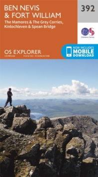
Add to BasketBen Nevis and Fort William, the Mamores and the Grey Corries, Kinlochleven and Spean Bridge
Ordnance Survey
In StockFree UK DeliveryEstimated delivery 2-3 working days
Format: Book (Sheet map, folded)
£12.99
£10.77
In StockFree UK DeliveryEstimated delivery 2-3 working days
Book (Sheet map, folded)
Add to BasketGower, Llanelli
Ordnance Survey
In StockFree UK DeliveryEstimated delivery 2-3 working days
Format: Book (Sheet map, folded)
£12.99
£10.77
In StockFree UK DeliveryEstimated delivery 2-3 working days
Book (Sheet map, folded)
Add to BasketCheddar Gorge and Mendip Hills West
Ordnance Survey
In StockFree UK DeliveryEstimated delivery 2-3 working days
Format: Book (Sheet map, folded)
£12.99
£10.77
In StockFree UK DeliveryEstimated delivery 2-3 working days
Book (Sheet map, folded)
Add to BasketDartmoor
In StockFree UK DeliveryEstimated delivery 2-3 working days
Format: Book (Sheet map, folded)
£12.99
£11.30
In StockFree UK DeliveryEstimated delivery 2-3 working days
Book (Sheet map, folded)
Add to BasketThe English Lakes - North-Western Area : Keswick, Cockermouth & Wigton
In StockFree UK DeliveryEstimated delivery 2-3 working days
Format: Book (Sheet map, folded)
£12.99
£10.77
In StockFree UK DeliveryEstimated delivery 2-3 working days
Book (Sheet map, folded)
Add to BasketForest of Bowland & Ribblesdale, Pendle Hill, Clitheroe & Settle
Ordnance Survey
In StockFree UK DeliveryEstimated delivery 2-3 working days
Format: Book (Sheet map, folded)
£12.99
£10.77
In StockFree UK DeliveryEstimated delivery 2-3 working days
Book (Sheet map, folded)
Add to BasketA Walk from the Wild Edge : A journey of self-discovery and human connection
Jake Tyler
In StockFree UK DeliveryEstimated delivery 2-3 working days
Format: Book (Hardback)
£16.99
£13.12
In StockFree UK DeliveryEstimated delivery 2-3 working days
Book (Hardback)
Add to Basket


