North York Moors National Park Pocket Map : The Perfect Guide to Explore This Area of Outstanding Natural Beauty
National Parks UK
In StockFree UK DeliveryEstimated delivery 2-3 working days
Format: Book (Sheet map, folded)
£5.04
In StockFree UK DeliveryEstimated delivery 2-3 working days
Book (Sheet map, folded)
Add to BasketImray Chart C65 : Crinan to Mallaig and Barra
Imray
In StockFree UK DeliveryEstimated delivery 2-3 working days
Format: Book (Paperback / softback)
£25.95
£24.02
In StockFree UK DeliveryEstimated delivery 2-3 working days
Book (Paperback / softback)
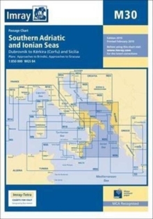
Add to BasketImray Chart M30 : Dubrovnik to Kerkira (Corfu) & Sicilia
Imray
In StockFree UK DeliveryEstimated delivery 2-3 working days
Format: Book (Paperback / softback)
£23.95
£22.49
In StockFree UK DeliveryEstimated delivery 2-3 working days
Book (Paperback / softback)
Add to BasketDartmoor National Park Pocket Map : The Perfect Guide to Explore This Area of Outstanding Natural Beauty
National Parks UK
In StockFree UK DeliveryEstimated delivery 2-3 working days
Format: Book (Sheet map, folded)
£5.04
In StockFree UK DeliveryEstimated delivery 2-3 working days
Book (Sheet map, folded)
Add to BasketThe River Thames : Including the River Wey, Basingstoke Canal and Kennet and Avon Canal
Imray
In StockFree UK DeliveryEstimated delivery 2-3 working days
Format: Book (Spiral bound)
£15.27
In StockFree UK DeliveryEstimated delivery 2-3 working days
Book (Spiral bound)
Add to BasketSouth West Coast Path National Trail Map
Collins Maps
In StockFree UK DeliveryEstimated delivery 2-3 working days
Format: Book (Sheet map, folded)
£7.32
In StockFree UK DeliveryEstimated delivery 2-3 working days
Book (Sheet map, folded)
Add to BasketImray Chart B3 : The Grenadines- St Vincent to Grenada
Imray
In StockFree UK DeliveryEstimated delivery 2-3 working days
Format: Book (Paperback / softback)
£23.95
£22.49
In StockFree UK DeliveryEstimated delivery 2-3 working days
Book (Paperback / softback)
Add to BasketArdnamurchan to Cape Wrath : Clyde Cruising Club Sailing Directions & Anchorages
Imray
In StockFree UK DeliveryEstimated delivery 2-3 working days
Format: Book (Spiral bound)
£37.50
£32.93
In StockFree UK DeliveryEstimated delivery 2-3 working days
Book (Spiral bound)
Add to BasketImray Chart C64 : North Channel - Belfast Lough to Lough Foyle and Crinan
Imray
In StockFree UK DeliveryEstimated delivery 2-3 working days
Format: Book (Paperback / softback)
£25.95
£24.02
In StockFree UK DeliveryEstimated delivery 2-3 working days
Book (Paperback / softback)
Add to BasketThe Lune Valley and Howgills : 40 scenic fell, river and woodland walks
Dennis Kelsall
In StockFree UK DeliveryEstimated delivery 2-3 working days
Format: Book (Paperback / softback)
£12.95
£10.77
In StockFree UK DeliveryEstimated delivery 2-3 working days
Book (Paperback / softback)
Add to BasketSouth Downs National Park Pocket Map : The Perfect Guide to Explore This Area of Outstanding Natural Beauty
National Parks UK
In StockFree UK DeliveryEstimated delivery 2-3 working days
Format: Book (Sheet map, folded)
£5.04
In StockFree UK DeliveryEstimated delivery 2-3 working days
Book (Sheet map, folded)
Add to BasketMunros and Corbetts Pocket Map : Discover Scotland’s Highest Peaks
Collins Maps
In StockFree UK DeliveryEstimated delivery 2-3 working days
Format: Book (Sheet map, folded)
£5.04
In StockFree UK DeliveryEstimated delivery 2-3 working days
Book (Sheet map, folded)
Add to BasketNorth Cornwall Coast : Bude to Land's End - Circular Walks along the South West Coast Path
Dennis Kelsall
In StockFree UK DeliveryEstimated delivery 2-3 working days
Format: Book (Paperback / softback)
£7.12
In StockFree UK DeliveryEstimated delivery 2-3 working days
Book (Paperback / softback)
Add to BasketCairngorms National Park Pocket Map : The Perfect Guide to Explore This Area of Outstanding Natural Beauty
National Parks UK
In StockFree UK DeliveryEstimated delivery 2-3 working days
Format: Book (Sheet map, folded)
£5.04
In StockFree UK DeliveryEstimated delivery 2-3 working days
Book (Sheet map, folded)
Add to BasketCruising Anglesey and Adjoining Waters : From Liverpool to Aberdovey
Imray
In StockFree UK DeliveryEstimated delivery 2-3 working days
Format: Book (Paperback / softback)
£37.50
£32.93
In StockFree UK DeliveryEstimated delivery 2-3 working days
Book (Paperback / softback)
Add to BasketImray Chart M40 : Ligurian and Tyrrhenian Sea
Imray
In StockFree UK DeliveryEstimated delivery 2-3 working days
Format: Book (Sheet map, folded)
£23.95
£22.49
In StockFree UK DeliveryEstimated delivery 2-3 working days
Book (Sheet map, folded)
Add to BasketThe Jurassic Coast (Lyme Regis to Poole Harbour) : Circular Walks along the South West Coast Path
Dennis Kelsall
In StockFree UK DeliveryEstimated delivery 2-3 working days
Format: Book (Paperback / softback)
£7.12
In StockFree UK DeliveryEstimated delivery 2-3 working days
Book (Paperback / softback)
Add to BasketThe Peak District
Jan Kelsall
In StockFree UK DeliveryEstimated delivery 2-3 working days
Format: Book (Paperback / softback)
£7.99
£7.79
In StockFree UK DeliveryEstimated delivery 2-3 working days
Book (Paperback / softback)
Add to BasketSnowdonia National Park Pocket Map : The Perfect Guide to Explore This Area of Outstanding Natural Beauty
National Parks UK
In StockFree UK DeliveryEstimated delivery 2-3 working days
Format: Book (Sheet map, folded)
£5.04
In StockFree UK DeliveryEstimated delivery 2-3 working days
Book (Sheet map, folded)
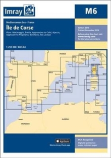
Add to BasketImray Chart M6 : Ile de Corse
Imray
In StockFree UK DeliveryEstimated delivery 2-3 working days
Format: Book (Sheet map, folded)
£23.95
£22.49
In StockFree UK DeliveryEstimated delivery 2-3 working days
Book (Sheet map, folded)
Add to BasketImray Chart G11 : North Ionian Islands
Imray
In StockFree UK DeliveryEstimated delivery 2-3 working days
Format: Book (Sheet map, folded)
£23.95
£22.49
In StockFree UK DeliveryEstimated delivery 2-3 working days
Book (Sheet map, folded)
Add to BasketImray Chart G25 : Northern Sporades and North Evvoia
Imray
In StockFree UK DeliveryEstimated delivery 2-3 working days
Format: Book (Sheet map, folded)
£23.95
£22.49
In StockFree UK DeliveryEstimated delivery 2-3 working days
Book (Sheet map, folded)
Add to BasketHadrian’s Wall Path National Trail Map
Collins Maps
In StockFree UK DeliveryEstimated delivery 2-3 working days
Format: Book (Sheet map, folded)
£7.32
In StockFree UK DeliveryEstimated delivery 2-3 working days
Book (Sheet map, folded)
Add to BasketSouth Downs Way National Trail Map
Collins Maps
In StockFree UK DeliveryEstimated delivery 2-3 working days
Format: Book (Sheet map, folded)
£7.32
In StockFree UK DeliveryEstimated delivery 2-3 working days
Book (Sheet map, folded)
Add to Basket


