Imray 2100 Chart Pack : Kent and Sussex Coasts
Imray
In StockFree UK DeliveryEstimated delivery 2-3 working days
Format: Book (Loose-leaf)
£54.95
£53.51
In StockFree UK DeliveryEstimated delivery 2-3 working days
Book (Loose-leaf)
Add to BasketFenland Waterways : River Nene to River Great Ouse via Middle Level link route and alternatives
Chris Howes
In StockFree UK DeliveryEstimated delivery 2-3 working days
Format: Book (Spiral bound)
£13.27
In StockFree UK DeliveryEstimated delivery 2-3 working days
Book (Spiral bound)
Add to BasketThe River Thames : Including the River Wey, Basingstoke Canal and Kennet and Avon Canal
Imray
In StockFree UK DeliveryEstimated delivery 2-3 working days
Format: Book (Spiral bound)
£15.21
In StockFree UK DeliveryEstimated delivery 2-3 working days
Book (Spiral bound)
Add to BasketImray 2800 Chart Pack : Kintyre to Ardnamurchan Chart Pack
Imray
In StockFree UK DeliveryEstimated delivery 2-3 working days
Format: Book (Loose-leaf)
The River Great Ouse and its tributaries : including the Rivers Cam, Lark, Little Ouse & Wissey, Hundred Foot River, Relief Channel
Chris Howes
Out of StockMore expected soonContact us for further information
Format: Book (Spiral bound)
£16.21
Out of StockMore expected soonContact us for further information
Book (Spiral bound)
Add to BasketSkipper's Cockpit Weather Guide
Frank Singleton
In StockFree UK DeliveryEstimated delivery 2-3 working days
Format: Book (Spiral bound)
£12.99
£12.56
In StockFree UK DeliveryEstimated delivery 2-3 working days
Book (Spiral bound)
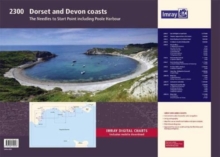
Add to BasketImray 2300 : Dorset and Devon Coasts Chart Pack
Imray, Laurie, Norie & Wilson Ltd
In StockFree UK DeliveryEstimated delivery 2-3 working days
Format: Book (Loose-leaf)
2100 Kent and Sussex Coasts Chart Pack : Thames Estuary to the Solent 2000 Chart Series
Imray
In StockFree UK DeliveryEstimated delivery 2-3 working days
Format: Book (Loose-leaf)
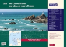
Imray 2500 Chart Pack : The Channel Islands and adjacent coast of France
Imray
In StockFree UK DeliveryEstimated delivery 2-3 working days
Format: Book (Loose-leaf)
Skipper's Cockpit Navigation Guide
Rene Westerhuis
In StockFree UK DeliveryEstimated delivery 2-3 working days
Format: Book (Spiral bound)
£12.99
£12.31
In StockFree UK DeliveryEstimated delivery 2-3 working days
Book (Spiral bound)
Add to BasketImray 2100 : Kent and Sussex Coasts Chart Pack Wiro-bound
Imray
Out of StockMore expected soonContact us for further information
Format: Book (Spiral bound)
£59.95
£57.94
Out of StockMore expected soonContact us for further information
Book (Spiral bound)
Add to BasketImray 3200 Islas Baleares Chart Pack
Imray
Out of StockMore expected soonContact us for further information
Format: Book (Loose-leaf)
£56.76
Out of StockMore expected soonContact us for further information
Book (Loose-leaf)
Add to BasketImray Chart Pack 3200 : Islas Baleares Wiro Bound
Imray
Out of StockMore expected soonContact us for further information
Format: Book (Spiral bound)
£61.48
Out of StockMore expected soonContact us for further information
Book (Spiral bound)
Add to Basket2600 Bristol Channel Chart Pack : Trevose Head to St David's Head including the River Severn
Imray
Out of StockMore expected soonContact us for further information
Format: Book (Loose-leaf)
£56.76
Out of StockMore expected soonContact us for further information
Book (Loose-leaf)
Add to Basket2600 Bristol Channel Chart Pack Wirobound : Trevose Head to St David's Head including the River Severn
Imray
Out of StockMore expected soonContact us for further information
Format: Book (Spiral bound)
£61.48
Out of StockMore expected soonContact us for further information
Book (Spiral bound)
Add to BasketImray 2000 Suffolk and Essex Chart Pack Wiro Bound : Lowestoft to River Crouch
Imray
Out of Stock - We are unable to provide an estimated availability date for this product
Format: Book (Spiral bound)
£59.95
£53.21
Out of Stock - We are unable to provide an estimated availability date for this product
Book (Spiral bound)
Add to Basket2300 : Dorset and Devon Coasts Chart Pack Wiro Bound
Imray, laurie Norie & Wilson Ltd
Out of Stock - We are unable to provide an estimated availability date for this product
Format: Book (Spiral bound)
£59.95
£57.94
Out of Stock - We are unable to provide an estimated availability date for this product
Book (Spiral bound)
Add to Basket


