Bradshaw's Railway Map Great Britain and Ireland 1852
George Bradshaw
In StockFree UK DeliveryEstimated delivery 2-3 working days
Format: Book (Sheet map, folded)
£19.99
£17.09
In StockFree UK DeliveryEstimated delivery 2-3 working days
Book (Sheet map, folded)
Add to BasketHadrian’s Wall Path National Trail Map
Collins Maps
In StockFree UK DeliveryEstimated delivery 2-3 working days
Format: Book (Sheet map, folded)
£7.32
In StockFree UK DeliveryEstimated delivery 2-3 working days
Book (Sheet map, folded)
Add to BasketThe Clans and Tartans Map of Scotland : Folded, with Cover - A colourful, illustrated map of clan lands with 150 registered clan tartans, plus information about Highland Dress, the story of tartan, an
Waverley Books Waverley Books
In StockFree UK DeliveryEstimated delivery 2-3 working days
Format: Book (Sheet map, folded)
£8.99
£7.94
In StockFree UK DeliveryEstimated delivery 2-3 working days
Book (Sheet map, folded)
Add to BasketBradshaw's Railway Map Central Europe 1913
George Bradshaw
In StockFree UK DeliveryEstimated delivery 2-3 working days
Format: Book (Sheet map, folded)
£14.99
£13.72
In StockFree UK DeliveryEstimated delivery 2-3 working days
Book (Sheet map, folded)
Add to BasketCollins Scotland Clans and Tartans Map : Over 170 Arms, Official Insignia, Crests and Tartans of Scottish Clans
Collins Maps
In StockFree UK DeliveryEstimated delivery 2-3 working days
Format: Book (Sheet map, folded)
£6.76
In StockFree UK DeliveryEstimated delivery 2-3 working days
Book (Sheet map, folded)
Add to BasketMadeira Bus and Touring Map
David Brawn
In StockFree UK DeliveryEstimated delivery 2-3 working days
Format: Book (Sheet map)
Northumberland National Park Pocket Map : The Perfect Guide to Explore This Area of Outstanding Natural Beauty
National Parks UK
In StockFree UK DeliveryEstimated delivery 2-3 working days
Format: Book (Sheet map, folded)
£5.04
In StockFree UK DeliveryEstimated delivery 2-3 working days
Book (Sheet map, folded)
Add to BasketAn Historical Map of Oxford: From Medieval to Victorian Times (New Edition)
Alan Crossley
In StockFree UK DeliveryEstimated delivery 2-3 working days
Format: Book (Sheet map, folded)
£9.99
£8.73
In StockFree UK DeliveryEstimated delivery 2-3 working days
Book (Sheet map, folded)
Add to BasketDiscovering Glasgow Illustrated Map : Ideal for Exploring
Dominic Beddow
In StockFree UK DeliveryEstimated delivery 2-3 working days
Format: Book (Sheet map, folded)
£6.76
In StockFree UK DeliveryEstimated delivery 2-3 working days
Book (Sheet map, folded)
Add to BasketBrecon Beacons National Park Pocket Map : The Perfect Guide to Explore This Area of Outstanding Natural Beauty
National Parks UK
In StockFree UK DeliveryEstimated delivery 2-3 working days
Format: Book (Sheet map, folded)
£5.04
In StockFree UK DeliveryEstimated delivery 2-3 working days
Book (Sheet map, folded)
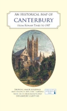
Add to BasketAn Historical Map of Canterbury from medieval times to 1907
Jake Weekes
In StockFree UK DeliveryEstimated delivery 2-3 working days
Format: Book (Sheet map, folded)
£9.99
£8.45
In StockFree UK DeliveryEstimated delivery 2-3 working days
Book (Sheet map, folded)
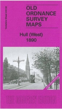
Add to BasketHull (West) 1890 : Yorkshire Sheet 240.02
Susan Neave
In StockFree UK DeliveryEstimated delivery 2-3 working days
Format: Book (Sheet map, folded)
£5.04
In StockFree UK DeliveryEstimated delivery 2-3 working days
Book (Sheet map, folded)
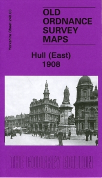
Add to BasketHull (East) 1908 : Yorkshire Sheet 240.03
Susan Neave
In StockFree UK DeliveryEstimated delivery 2-3 working days
Format: Book (Sheet map, folded)
£5.04
In StockFree UK DeliveryEstimated delivery 2-3 working days
Book (Sheet map, folded)
Add to BasketLeeds (SE) 1890 : Yorkshire Sheet 218.06
Alan Godfrey
In StockFree UK DeliveryEstimated delivery 2-3 working days
Format: Book (Sheet map, folded)
£5.04
In StockFree UK DeliveryEstimated delivery 2-3 working days
Book (Sheet map, folded)
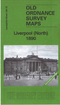
Add to BasketLiverpool (North) 1890: Lancashire Sheet 106.10A : Coloured Edition
Kay Parrott
In StockFree UK DeliveryEstimated delivery 2-3 working days
Format: Book (Sheet map, folded)
£5.04
In StockFree UK DeliveryEstimated delivery 2-3 working days
Book (Sheet map, folded)
Add to BasketMiddlesbrough (North) 1893 : Yorkshire Sheet 6.10a
Robert Woodhouse
In StockFree UK DeliveryEstimated delivery 2-3 working days
Format: Book (Sheet map, folded)
£5.04
In StockFree UK DeliveryEstimated delivery 2-3 working days
Book (Sheet map, folded)
Add to BasketPaisley 1858 : Renfrewshire Sheet 12.02a
Gilbert Bell
In StockFree UK DeliveryEstimated delivery 2-3 working days
Format: Book (Sheet map, folded)
£5.04
In StockFree UK DeliveryEstimated delivery 2-3 working days
Book (Sheet map, folded)
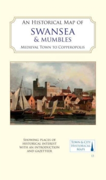
Add to BasketAn Historical Map of Swansea & Mumbles : medieval town to Copperopolis
Matthew Stevens
In StockFree UK DeliveryEstimated delivery 2-3 working days
Format: Book (Sheet map, folded)
£10.99
£9.18
In StockFree UK DeliveryEstimated delivery 2-3 working days
Book (Sheet map, folded)
Add to BasketLeeds (NW) 1889 : Yorkshire Sheet 218.01
Alan Godfrey
In StockFree UK DeliveryEstimated delivery 2-3 working days
Format: Book (Sheet map, folded)
£5.04
In StockFree UK DeliveryEstimated delivery 2-3 working days
Book (Sheet map, folded)
Add to BasketHull (East) 1890 : Yorkshire Sheet 240.03
Susan Neave
In StockFree UK DeliveryEstimated delivery 2-3 working days
Format: Book (Sheet map, folded)
£5.04
In StockFree UK DeliveryEstimated delivery 2-3 working days
Book (Sheet map, folded)
Add to BasketCentral Middlesbrough 1892 : Yorkshire Sheet 6.14a
Robert Woodhouse
In StockFree UK DeliveryEstimated delivery 2-3 working days
Format: Book (Sheet map, folded)
£5.04
In StockFree UK DeliveryEstimated delivery 2-3 working days
Book (Sheet map, folded)
Add to BasketToxteth 1890: Lancashire Sheet 113.02a : Coloured Edition
Kay Parrott
In StockFree UK DeliveryEstimated delivery 2-3 working days
Format: Book (Sheet map, folded)
£5.04
In StockFree UK DeliveryEstimated delivery 2-3 working days
Book (Sheet map, folded)
Add to BasketHeadingley 1890: Yorkshire Sheet 203.13a : Coloured Edition
Alan Godfrey
In StockFree UK DeliveryEstimated delivery 2-3 working days
Format: Book (Sheet map, folded)
£5.04
In StockFree UK DeliveryEstimated delivery 2-3 working days
Book (Sheet map, folded)
Add to BasketKirkdale 1890 : Lancashire Sheet 106.06 Coloured Edition
Kay Parrott
In StockFree UK DeliveryEstimated delivery 2-3 working days
Format: Book (Sheet map, folded)
£5.04
In StockFree UK DeliveryEstimated delivery 2-3 working days
Book (Sheet map, folded)
Add to Basket


