Nicholson Inland Waterways Map of Great Britain : For Everyone with an Interest in Britain’s Canals and Rivers
Nicholson Waterways Guides
In StockFree UK DeliveryEstimated delivery 2-3 working days
Format: Book (Sheet map, folded)
£8.99
£8.45
In StockFree UK DeliveryEstimated delivery 2-3 working days
Book (Sheet map, folded)
Add to BasketG12 South Ionian Islands : Nisos Levkas to Nisos Zakinthos
Imray
In StockFree UK DeliveryEstimated delivery 2-3 working days
Format: Book (Sheet map, folded)
£25.68
In StockFree UK DeliveryEstimated delivery 2-3 working days
Book (Sheet map, folded)
Add to BasketG3 Aegean Sea (South)
Rod & Lu Heikell
In StockFree UK DeliveryEstimated delivery 2-3 working days
Format: Book (Sheet map, folded)
£25.68
In StockFree UK DeliveryEstimated delivery 2-3 working days
Book (Sheet map, folded)
Add to BasketImray Chart G31 : Northern Cyclades
Imray
In StockFree UK DeliveryEstimated delivery 2-3 working days
Format: Book (Sheet map, folded)
£25.68
In StockFree UK DeliveryEstimated delivery 2-3 working days
Book (Sheet map, folded)
Add to BasketImray Chart G32 : Eastern Sporades, Dodecanese & the Coast of Turkey
Imray
In StockFree UK DeliveryEstimated delivery 2-3 working days
Format: Book (Sheet map, folded)
£25.68
In StockFree UK DeliveryEstimated delivery 2-3 working days
Book (Sheet map, folded)
Add to BasketImray Chart G33 : Southern Cyclades
Imray
In StockFree UK DeliveryEstimated delivery 2-3 working days
Format: Book (Sheet map, folded)
£25.68
In StockFree UK DeliveryEstimated delivery 2-3 working days
Book (Sheet map, folded)
Add to BasketImray Chart G34 : Southern Cyclades
Imray
In StockFree UK DeliveryEstimated delivery 2-3 working days
Format: Book (Sheet map, folded)
£25.68
In StockFree UK DeliveryEstimated delivery 2-3 working days
Book (Sheet map, folded)
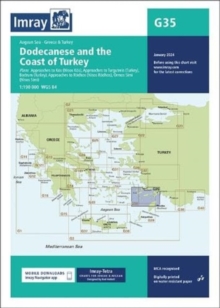
Add to BasketImray Chart G35 : Dodecanese and the Coast of Turkey
Imray
In StockFree UK DeliveryEstimated delivery 2-3 working days
Format: Book (Sheet map, folded)
£25.68
In StockFree UK DeliveryEstimated delivery 2-3 working days
Book (Sheet map, folded)
Add to BasketG1 Mainland Greece and the Peloponnisos : Passage Chart
In StockFree UK DeliveryEstimated delivery 2-3 working days
Format: Book (Sheet map, folded)
£25.68
In StockFree UK DeliveryEstimated delivery 2-3 working days
Book (Sheet map, folded)
Add to BasketImray G141 Chart : Saronikos Kolpos
Imray
In StockFree UK DeliveryEstimated delivery 2-3 working days
Format: Book (Sheet map, folded)
£25.68
In StockFree UK DeliveryEstimated delivery 2-3 working days
Book (Sheet map, folded)
Add to BasketImray Chart G15 : Southern Peloponnisos
Imray
In StockFree UK DeliveryEstimated delivery 2-3 working days
Format: Book (Sheet map, folded)
£25.68
In StockFree UK DeliveryEstimated delivery 2-3 working days
Book (Sheet map, folded)
Add to BasketImray Chart G16 : Western Peloponnisos
Imray
In StockFree UK DeliveryEstimated delivery 2-3 working days
Format: Book (Sheet map, folded)
£25.68
In StockFree UK DeliveryEstimated delivery 2-3 working days
Book (Sheet map, folded)
Add to BasketImray Chart C8 : Dover Strait
Imray
In StockFree UK DeliveryEstimated delivery 2-3 working days
Format: Book (Sheet map, folded)
£27.45
In StockFree UK DeliveryEstimated delivery 2-3 working days
Book (Sheet map, folded)
Add to BasketImray Chart C9 : Beachy Head to Isle of Wight
Imray
In StockFree UK DeliveryEstimated delivery 2-3 working days
Format: Book (Sheet map, folded)
£27.45
In StockFree UK DeliveryEstimated delivery 2-3 working days
Book (Sheet map, folded)
Add to BasketImray Chart Y14 : The Swale (Small Format)
Imray
In StockFree UK DeliveryEstimated delivery 2-3 working days
Format: Book (Sheet map, folded)
£18.84
In StockFree UK DeliveryEstimated delivery 2-3 working days
Book (Sheet map, folded)
Add to BasketImray Chart Y18 : The River Medway and Approaches
Imray
In StockFree UK DeliveryEstimated delivery 2-3 working days
Format: Book (Sheet map, folded)
£25.29
In StockFree UK DeliveryEstimated delivery 2-3 working days
Book (Sheet map, folded)
Add to BasketImray Chart Y7 : Thames Estuary South
Imray
In StockFree UK DeliveryEstimated delivery 2-3 working days
Format: Book (Sheet map, folded)
£18.84
In StockFree UK DeliveryEstimated delivery 2-3 working days
Book (Sheet map, folded)
Add to BasketImray Chart C2 : The River Thames
Imray
In StockFree UK DeliveryEstimated delivery 2-3 working days
Format: Book (Sheet map, folded)
£27.45
In StockFree UK DeliveryEstimated delivery 2-3 working days
Book (Sheet map, folded)
Add to BasketZillertal Hiking, Cycling and Leisure Map : Tuxer Alpen, Jenbach, Schwaz 1:50,000 scale 151
Out of StockMore expected soonContact us for further information
Format: Book (Sheet map, folded)
£12.90
£11.51
Out of StockMore expected soonContact us for further information
Book (Sheet map, folded)
Add to BasketThe Ultimate Netherlands, Belgium & Luxembourg Cycle Route Planner
Richard Peace
Out of StockMore expected soonContact us for further information
Format: Book (Sheet map, folded)
£9.99
Out of StockMore expected soonContact us for further information
Book (Sheet map, folded)
Add to BasketOstfriesland, cycling and leisure map 1:75,000, freytag & berndt, RK 0136
Out of StockMore expected soonContact us for further information
Format: Book (Sheet map, folded)
£9.95
Out of StockMore expected soonContact us for further information
Book (Sheet map, folded)
Add to BasketOtztal Hiking, Cycling and Leisure Map : Pitztal, Kaunertal, Wildspitze WK251 251
Out of StockMore expected soonContact us for further information
Format: Book (Sheet map, folded)
£12.90
£11.51
Out of StockMore expected soonContact us for further information
Book (Sheet map, folded)
Add to BasketAlsace South cycle map : ELSS
Out of StockMore expected soonContact us for further information
Format: Book (Sheet map, folded)
£9.99
£9.78
Out of StockMore expected soonContact us for further information
Book (Sheet map, folded)
Add to BasketLuneburger Heide Nord cycle map : NDS03
Out of StockMore expected soonContact us for further information
Format: Book (Sheet map, folded)
£9.99
£9.78
Out of StockMore expected soonContact us for further information
Book (Sheet map, folded)
Add to Basket


