Oregon Recreation Map
Benchmark Maps
Out of StockMore expected soonContact us for further information
Format: Book (Sheet map, folded)
£10.01
Out of StockMore expected soonContact us for further information
Book (Sheet map, folded)
Add to BasketUtah Recreation Map
Benchmark Maps
Out of StockMore expected soonContact us for further information
Format: Book (Sheet map, folded)
£10.01
Out of StockMore expected soonContact us for further information
Book (Sheet map, folded)
Add to BasketWashington Recreation Map
Benchmark Maps
Out of StockMore expected soonContact us for further information
Format: Book (Sheet map, folded)
£10.01
Out of StockMore expected soonContact us for further information
Book (Sheet map, folded)
Add to BasketGlen Coe : Glen Etive & Black Mount
Out of StockMore expected soonContact us for further information
Format: Book (Sheet map, flat)
£11.67
Out of StockMore expected soonContact us for further information
Book (Sheet map, flat)
Add to BasketOtztal Hiking, Cycling and Leisure Map : Pitztal, Kaunertal, Wildspitze WK251 251
In StockFree UK DeliveryEstimated delivery 2-3 working days
Format: Book (Sheet map, folded)
£12.90
£10.81
In StockFree UK DeliveryEstimated delivery 2-3 working days
Book (Sheet map, folded)
Add to BasketZell am See - Kaprun Hiking, Cycling and Leisure Map : 1:50,000 scale 382
In StockFree UK DeliveryEstimated delivery 2-3 working days
Format: Book (Sheet map, folded)
£12.90
£10.81
In StockFree UK DeliveryEstimated delivery 2-3 working days
Book (Sheet map, folded)
Add to BasketMadeira Hiking, Cycling & Leisure Map : 1:30,000 scale 1
In StockFree UK DeliveryEstimated delivery 2-3 working days
Format: Book (Sheet map, folded)
£12.90
£10.81
In StockFree UK DeliveryEstimated delivery 2-3 working days
Book (Sheet map, folded)
Add to BasketBregenzerwald Hiking, cycling & Leisure Map : 364
In StockFree UK DeliveryEstimated delivery 2-3 working days
Format: Book (Sheet map, folded)
£12.90
£10.81
In StockFree UK DeliveryEstimated delivery 2-3 working days
Book (Sheet map, folded)
Add to BasketMontafon - Klostertal - Silvretta Hiking, Cycling & Leisure Map : 374
In StockFree UK DeliveryEstimated delivery 2-3 working days
Format: Book (Sheet map, folded)
£12.90
£10.81
In StockFree UK DeliveryEstimated delivery 2-3 working days
Book (Sheet map, folded)
Add to BasketKleinwalsertal Hiking, Cycling & Leisure Map : 5364
In StockFree UK DeliveryEstimated delivery 2-3 working days
Format: Book (Sheet map, folded)
£12.90
£10.81
In StockFree UK DeliveryEstimated delivery 2-3 working days
Book (Sheet map, folded)
Add to BasketLandeck - Reschenpass Hiking, Cycling & Leisure Map : 254
In StockFree UK DeliveryEstimated delivery 2-3 working days
Format: Book (Sheet map, folded)
£12.90
£10.81
In StockFree UK DeliveryEstimated delivery 2-3 working days
Book (Sheet map, folded)
Add to BasketLechtaler Alpen - Allgauer Alpen Hiking, Cycling & Leisure Map : 351
In StockFree UK DeliveryEstimated delivery 2-3 working days
Format: Book (Sheet map, folded)
£12.90
£10.81
In StockFree UK DeliveryEstimated delivery 2-3 working days
Book (Sheet map, folded)
Add to BasketPasseiertal, Val Passiria GPS wp D/I/E +AG : 044
Out of StockMore expected soonContact us for further information
Format: Book (Sheet map, folded)
£13.99
£13.20
Out of StockMore expected soonContact us for further information
Book (Sheet map, folded)
Add to BasketGrand Canyon Day Hikes and National Park [Map Pack Bundle]
National Geographic Maps
Out of StockMore expected soonContact us for further information
Format: Book (Sheet map, folded)
£24.95
£18.81
Out of StockMore expected soonContact us for further information
Book (Sheet map, folded)
Add to BasketCamino de Santiago East Map Map Pack Bundle : 2 map set
National Geographic Maps
In StockFree UK DeliveryEstimated delivery 2-3 working days
Format: Book (Sheet map, folded)
£24.95
£17.81
In StockFree UK DeliveryEstimated delivery 2-3 working days
Book (Sheet map, folded)
Add to BasketCamino de Santiago - Camino Frances West Map Pack Bundle : 2 Map set
National Geographic Maps
In StockFree UK DeliveryEstimated delivery 2-3 working days
Format: Book (Sheet map, folded)
£24.95
£17.81
In StockFree UK DeliveryEstimated delivery 2-3 working days
Book (Sheet map, folded)
Add to BasketMoab Day Hikes Map Guide
National Geographic Maps
Out of StockMore expected soonContact us for further information
Format: Book (Sheet map, folded)
£14.95
£12.96
Out of StockMore expected soonContact us for further information
Book (Sheet map, folded)
Add to BasketLyme Regis and Bridport
Ordnance Survey
In StockFree UK DeliveryEstimated delivery 2-3 working days
Format: Book (Sheet map, folded)
£12.99
£10.72
In StockFree UK DeliveryEstimated delivery 2-3 working days
Book (Sheet map, folded)
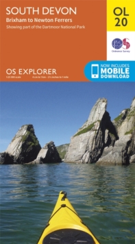
Add to BasketSouth Devon, Brixham to Newton Ferrers
Ordnance Survey
In StockFree UK DeliveryEstimated delivery 2-3 working days
Format: Book (Sheet map, folded)
£12.99
£10.72
In StockFree UK DeliveryEstimated delivery 2-3 working days
Book (Sheet map, folded)
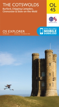
Add to BasketThe Cotswolds, Burford, Chipping Campden, Cirencester & Stow-on-the Wold
Ordnance Survey
In StockFree UK DeliveryEstimated delivery 2-3 working days
Format: Book (Sheet map, folded)
£12.99
£10.72
In StockFree UK DeliveryEstimated delivery 2-3 working days
Book (Sheet map, folded)
Add to BasketNorth York Moors - Western Area
Ordnance Survey
In StockFree UK DeliveryEstimated delivery 2-3 working days
Format: Book (Sheet map, folded)
£12.99
£10.72
In StockFree UK DeliveryEstimated delivery 2-3 working days
Book (Sheet map, folded)
Add to BasketSouth Pembrokeshire / De Sir Benfro
Ordnance Survey
In StockFree UK DeliveryEstimated delivery 2-3 working days
Format: Book (Sheet map, folded)
£12.99
£10.72
In StockFree UK DeliveryEstimated delivery 2-3 working days
Book (Sheet map, folded)
Add to BasketRutland Water, Stamford and Oakham
Ordnance Survey
In StockFree UK DeliveryEstimated delivery 2-3 working days
Format: Book (Sheet map, folded)
£12.99
£10.72
In StockFree UK DeliveryEstimated delivery 2-3 working days
Book (Sheet map, folded)
Add to BasketYorkshire Dales South & Western
Ordnance Survey
In StockFree UK DeliveryEstimated delivery 2-3 working days
Format: Book (Sheet map, folded)
£12.99
£10.72
In StockFree UK DeliveryEstimated delivery 2-3 working days
Book (Sheet map, folded)
Add to Basket


![Grand Canyon Day Hikes and National Park [Map Pack Bundle] - Book Grand Canyon Day Hikes and National Park [Map Pack Bundle] - Book](http://speedyhen.dmmserver.com/media/356/97815669/9781566959131.jpg)


