Imray Chart Y14 : The Swale (Small Format)
Imray
In StockFree UK DeliveryEstimated delivery 2-3 working days
Format: Book (Sheet map, folded)
£18.84
In StockFree UK DeliveryEstimated delivery 2-3 working days
Book (Sheet map, folded)
Add to BasketImray Chart Y7 : Thames Estuary South
Imray
In StockFree UK DeliveryEstimated delivery 2-3 working days
Format: Book (Sheet map, folded)
£18.84
In StockFree UK DeliveryEstimated delivery 2-3 working days
Book (Sheet map, folded)
Add to BasketImray Chart A233 : Virgin Islands
Imray
In StockFree UK DeliveryEstimated delivery 2-3 working days
Format: Book (Sheet map, folded)
£35.59
In StockFree UK DeliveryEstimated delivery 2-3 working days
Book (Sheet map, folded)
Add to BasketAdriatic Pilot : Croatia, Slovenia, Montenegro, East Coast of Italy, Albania
Trevor & Dinah Thompson
In StockFree UK DeliveryEstimated delivery 2-3 working days
Format: Book (Hardback)
£47.50
£41.28
In StockFree UK DeliveryEstimated delivery 2-3 working days
Book (Hardback)
Add to BasketImray : Map of the Inland Waterways of France 3
David Edwards-May
In StockFree UK DeliveryEstimated delivery 2-3 working days
Format: Book (Paperback / softback)
£13.02
In StockFree UK DeliveryEstimated delivery 2-3 working days
Book (Paperback / softback)
Add to BasketThe River Thames : Including the River Wey, Basingstoke Canal and Kennet and Avon Canal
Imray
In StockFree UK DeliveryEstimated delivery 2-3 working days
Format: Book (Spiral bound)
£15.21
In StockFree UK DeliveryEstimated delivery 2-3 working days
Book (Spiral bound)
Add to BasketAtlantic France : Cruising Ouessant to the Spanish Border
Imray
In StockFree UK DeliveryEstimated delivery 2-3 working days
Format: Book (Hardback)
£47.50
£41.28
In StockFree UK DeliveryEstimated delivery 2-3 working days
Book (Hardback)
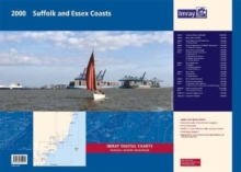
Add to Basket2000 Suffolk and Essex Chart Pack : Lowestoft to River Crouch
Imray
In StockFree UK DeliveryEstimated delivery 2-3 working days
Format: Book (Paperback / softback)
£54.95
£46.99
In StockFree UK DeliveryEstimated delivery 2-3 working days
Book (Paperback / softback)
Add to BasketSouth China Sea : Singapore to Hong Kong via the Gulf of Thailand, Malaysia, Brunei, the Philippines and Taiwan
Imray
In StockFree UK DeliveryEstimated delivery 2-3 working days
Format: Book (Hardback)
£55.00
£47.02
In StockFree UK DeliveryEstimated delivery 2-3 working days
Book (Hardback)
Add to BasketImray Chart Y49 : Isles of Scilly (Small Format)
Imray
In StockFree UK DeliveryEstimated delivery 2-3 working days
Format: Book (Sheet map, folded)
£18.84
In StockFree UK DeliveryEstimated delivery 2-3 working days
Book (Sheet map, folded)
Add to BasketImray Chart Y2 : Rivers Ore and Alde
Imray
In StockFree UK DeliveryEstimated delivery 2-3 working days
Format: Book (Paperback / softback)
£16.95
£16.94
In StockFree UK DeliveryEstimated delivery 2-3 working days
Book (Paperback / softback)
Add to BasketImray Chart Y6 : Suffolk and Essex Coasts
Imray
In StockFree UK DeliveryEstimated delivery 2-3 working days
Format: Book (Paperback / softback)
£16.95
£16.94
In StockFree UK DeliveryEstimated delivery 2-3 working days
Book (Paperback / softback)
Add to BasketImray Chart Y12 : Rivers Stour and Orwell
Imray
In StockFree UK DeliveryEstimated delivery 2-3 working days
Format: Book (Sheet map, folded)
£16.95
£16.94
In StockFree UK DeliveryEstimated delivery 2-3 working days
Book (Sheet map, folded)
Add to BasketThe Cruising Almanac Tide Tables 2024
Imray
In StockFree UK DeliveryEstimated delivery 2-3 working days
Format: Book (Paperback / softback)
£21.50
£19.74
In StockFree UK DeliveryEstimated delivery 2-3 working days
Book (Paperback / softback)
Add to BasketMap of the River Thames
Imray
Out of StockMore expected soonContact us for further information
Format: Book (Sheet map, folded)
£11.66
Out of StockMore expected soonContact us for further information
Book (Sheet map, folded)
Add to BasketThe River Nene
Roger Green
In StockFree UK DeliveryEstimated delivery 2-3 working days
Format: Book (Paperback / softback)
£13.75
In StockFree UK DeliveryEstimated delivery 2-3 working days
Book (Paperback / softback)
Add to BasketImray Chart G36 : Marmaris to Kekova Adasi
Imray
Out of Stock - We are unable to provide an estimated availability date for this product
Format: Book (Paperback)
£19.95
£19.13
Out of Stock - We are unable to provide an estimated availability date for this product
Book (Paperback)
Add to BasketImray Chart Y32 : Eastern Approach to the Solent (Small Format)
Imray
Out of StockMore expected soonContact us for further information
Format: Book (Sheet map, folded)
£18.23
Out of StockMore expected soonContact us for further information
Book (Sheet map, folded)
Add to BasketImray Chart Y36 : Central Solent (Small Format)
Imray
Out of StockMore expected soonContact us for further information
Format: Book (Sheet map, folded)
£18.23
Out of StockMore expected soonContact us for further information
Book (Sheet map, folded)
Add to BasketImray Chart Y30 : Isle of Wight (Small Format)
Imray
Out of StockMore expected soonContact us for further information
Format: Book (Sheet map, folded)
£16.95
£16.94
Out of StockMore expected soonContact us for further information
Book (Sheet map, folded)
Add to BasketImray Chart Atlas 2110 : North France - Nord-Pas-de-Calais, Picardy and Normandy Coasts
Imray
Out of StockMore expected soonContact us for further information
Format: Book (Sheet map, flat)
£47.32
Out of StockMore expected soonContact us for further information
Book (Sheet map, flat)
Add to BasketMap of European Waterways
David Edwards-May
In StockFree UK DeliveryEstimated delivery 2-3 working days
Format: Book (Sheet map, folded)
£19.00
£17.68
In StockFree UK DeliveryEstimated delivery 2-3 working days
Book (Sheet map, folded)
Add to BasketImray Chart Y50 : Saint Mary's, Tresco and Surrounding Islands (Small Format)
Imray
Out of StockMore expected soonContact us for further information
Format: Book (Sheet map, folded)
£15.48
Out of StockMore expected soonContact us for further information
Book (Sheet map, folded)
Add to BasketImray Chart Y31 : Christchurch to the Solent (Small Format)
Imray
Out of StockMore expected soonContact us for further information
Format: Book (Sheet map, folded)
£18.23
Out of StockMore expected soonContact us for further information
Book (Sheet map, folded)
Add to Basket


