Snowdon
In StockFree UK DeliveryEstimated delivery 2-3 working days
Format: Book (Sheet map, folded)
£16.99
£12.97
In StockFree UK DeliveryEstimated delivery 2-3 working days
Book (Sheet map, folded)
Add to BasketImray Chart C34 : Cap d'Erquy to Ile de Batz
Imray
In StockFree UK DeliveryEstimated delivery 2-3 working days
Format: Book (Sheet map, folded)
£28.61
In StockFree UK DeliveryEstimated delivery 2-3 working days
Book (Sheet map, folded)
Add to BasketG3 Aegean Sea (South)
Rod & Lu Heikell
In StockFree UK DeliveryEstimated delivery 2-3 working days
Format: Book (Sheet map, folded)
£25.30
In StockFree UK DeliveryEstimated delivery 2-3 working days
Book (Sheet map, folded)
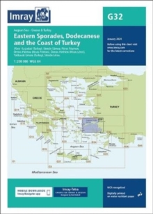
Add to BasketImray Chart G32 : Eastern Sporades, Dodecanese & the Coast of Turkey
Imray
In StockFree UK DeliveryEstimated delivery 2-3 working days
Format: Book (Sheet map, folded)
£25.30
In StockFree UK DeliveryEstimated delivery 2-3 working days
Book (Sheet map, folded)
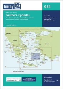
Add to BasketImray Chart G34 : Southern Cyclades
Imray
In StockFree UK DeliveryEstimated delivery 2-3 working days
Format: Book (Sheet map, folded)
£25.30
In StockFree UK DeliveryEstimated delivery 2-3 working days
Book (Sheet map, folded)
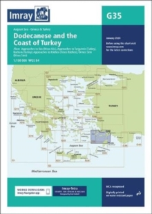
Add to BasketImray Chart G35 : Dodecanese and the Coast of Turkey
Imray
In StockFree UK DeliveryEstimated delivery 2-3 working days
Format: Book (Sheet map, folded)
£25.30
In StockFree UK DeliveryEstimated delivery 2-3 working days
Book (Sheet map, folded)
Add to BasketG1 Mainland Greece and the Peloponnisos : Passage Chart
In StockFree UK DeliveryEstimated delivery 2-3 working days
Format: Book (Sheet map, folded)
£25.30
In StockFree UK DeliveryEstimated delivery 2-3 working days
Book (Sheet map, folded)
Add to BasketImray Chart G15 : Southern Peloponnisos
Imray
In StockFree UK DeliveryEstimated delivery 2-3 working days
Format: Book (Sheet map, folded)
£25.30
In StockFree UK DeliveryEstimated delivery 2-3 working days
Book (Sheet map, folded)
Add to BasketImray Chart G16 : Western Peloponnisos
Imray
In StockFree UK DeliveryEstimated delivery 2-3 working days
Format: Book (Sheet map, folded)
£25.30
In StockFree UK DeliveryEstimated delivery 2-3 working days
Book (Sheet map, folded)
Add to BasketImray Chart C8 : Dover Strait
Imray
In StockFree UK DeliveryEstimated delivery 2-3 working days
Format: Book (Sheet map, folded)
£27.07
In StockFree UK DeliveryEstimated delivery 2-3 working days
Book (Sheet map, folded)
Add to BasketImray Chart C9 : Beachy Head to Isle of Wight
Imray
In StockFree UK DeliveryEstimated delivery 2-3 working days
Format: Book (Sheet map, folded)
£27.07
In StockFree UK DeliveryEstimated delivery 2-3 working days
Book (Sheet map, folded)
Add to BasketImray Chart Y14 : The Swale (Small Format)
Imray
In StockFree UK DeliveryEstimated delivery 2-3 working days
Format: Book (Sheet map, folded)
£18.42
In StockFree UK DeliveryEstimated delivery 2-3 working days
Book (Sheet map, folded)
Add to BasketImray Chart Y18 : The River Medway and Approaches
Imray
In StockFree UK DeliveryEstimated delivery 2-3 working days
Format: Book (Sheet map, folded)
£24.91
In StockFree UK DeliveryEstimated delivery 2-3 working days
Book (Sheet map, folded)
Add to BasketImray Chart Y7 : Thames Estuary South
Imray
In StockFree UK DeliveryEstimated delivery 2-3 working days
Format: Book (Sheet map, folded)
£18.42
In StockFree UK DeliveryEstimated delivery 2-3 working days
Book (Sheet map, folded)
Add to BasketImray Chart C2 : The River Thames
Imray
In StockFree UK DeliveryEstimated delivery 2-3 working days
Format: Book (Sheet map, folded)
£27.07
In StockFree UK DeliveryEstimated delivery 2-3 working days
Book (Sheet map, folded)
Add to BasketHarry Potters London the Film Location Walk : Includes Three Self-Guided Walks with Maps
Paul Garner
In StockFree UK DeliveryEstimated delivery 2-3 working days
Format: Book (Sheet map, folded)
£4.39
In StockFree UK DeliveryEstimated delivery 2-3 working days
Book (Sheet map, folded)
Add to BasketPurbeck & South Dorset, Poole, Dorchester, Weymouth & Swanage
Ordnance Survey
In StockFree UK DeliveryEstimated delivery 2-3 working days
Format: Book (Sheet map, folded)
£12.99
£10.77
In StockFree UK DeliveryEstimated delivery 2-3 working days
Book (Sheet map, folded)
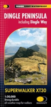
Add to BasketDingle Peninsula Superwalker XT30 : including Dingle Way
In StockFree UK DeliveryEstimated delivery 2-3 working days
Format: Book (Sheet map, folded)
£15.50
£13.20
In StockFree UK DeliveryEstimated delivery 2-3 working days
Book (Sheet map, folded)
Add to BasketWalker's Haute Route: Chamonix to Zermatt : Trekking Map - The Great Treks of the Alps
Andrew McCluggage
In StockFree UK DeliveryEstimated delivery 2-3 working days
Format: Book (Sheet map, folded)
£16.99
£12.68
In StockFree UK DeliveryEstimated delivery 2-3 working days
Book (Sheet map, folded)
Add to BasketEverest Base Camp Trekking Map : Classic EBC, Three Passes and Gokyo Lakes
Andrew McCluggage
Pre-OrderFree UK DeliveryThis title is available for pre-order
Format: Book (Sheet map)
£16.99
£13.69
Pre-OrderFree UK DeliveryThis title is available for pre-order
Book (Sheet map)
Pre-OrderZillertal Hiking, Cycling and Leisure Map : Tuxer Alpen, Jenbach, Schwaz 1:50,000 scale 151
Out of StockMore expected soonContact us for further information
Format: Book (Sheet map, folded)
£12.90
£11.10
Out of StockMore expected soonContact us for further information
Book (Sheet map, folded)
Add to BasketLechtaler Alpen / Hornbachkette : 24
Out of StockMore expected soonContact us for further information
Format: Book (Sheet map, folded)
£13.99
£12.78
Out of StockMore expected soonContact us for further information
Book (Sheet map, folded)
Add to BasketNorthumberland Coast Path : & Berwickshire Coastal Path
In StockFree UK DeliveryEstimated delivery 2-3 working days
Format: Book (Sheet map, folded)
£15.95
£12.99
In StockFree UK DeliveryEstimated delivery 2-3 working days
Book (Sheet map, folded)
Add to BasketTrekking Map: Tour des Combins : Switzerland & Italy
Andrew McCluggage
Pre-OrderFree UK DeliveryThis title is available for pre-order
Format: Book (Sheet map)
£16.99
£13.69
Pre-OrderFree UK DeliveryThis title is available for pre-order
Book (Sheet map)
Pre-Order


